 831-705-0888
Clayton Wildfire Protection: Fire Zone, Insurance and Home Hardening
Clayton sits directly at the base of Mount Diablo, with neighborhoods along Marsh Creek Road, Regency Drive, and the Oakhurst area backing onto the chaparral and grassland slopes of Mount Diablo State Park. The 2013 Morgan Fire burned more than 3,100 acres on the mountain immediately above town. Steep terrain, dense brush, and strong Diablo winds combine to make Clayton one of the most fire-exposed communities in Contra Costa County. FireRoofs does not install in Clayton. This page covers your fire zone and what helps a home here get through a wildfire.
CAL FIRE Risk Designation
Contra Costa County
Is there a fire near Clayton right now?
Open the live fire map →Wildfires, planned burns, NASA satellite heat and wind within 50 miles of Clayton. Updated every 5 minutes. Always follow official evacuation orders.
Clayton Fire Protection Resources
Fire Hazard Zone Lookup
Check whether your Clayton address is in a Very High, High, or Moderate Fire Hazard Severity Zone using CAL FIRE 2025 maps.
Look up your addressEvacuation Map
Contra Costa County evacuation zones, routes, and real-time status during active incidents.
Contra Costa County Evacuation Map (Genasys Protect)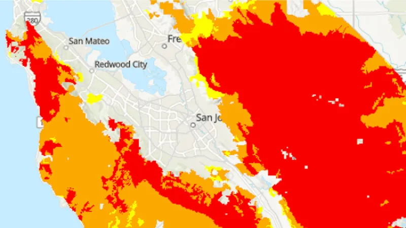
CAL FIRE Very High Fire Hazard Severity Zones (VHFHSZ) shown in red/orange
Source: CAL FIRE Fire Hazard Severity Zone data via Bay Area News Group
CAL FIRE VHFHSZ Designation
Very High FHSZ across the hillside neighborhoods bordering Mount Diablo State Park and the Marsh Creek corridor. Updated per 2025 CAL FIRE maps.
Clayton's Wildfire Record
Past fires help predict the next one. These are the biggest fires near Clayton.
Burned 3,111 acres on the slopes of Mount Diablo directly above Clayton, threatening homes and closing the state park for months.
Burned extensively across the Diablo Range southeast of Clayton and prompted evacuation warnings in eastern Contra Costa County.
Local Risk Factors
Mount Diablo Chaparral
Dense, fire-adapted chaparral on the mountain slopes above Clayton carries intense, fast-moving fire toward the community.
Direct State Park Interface
Neighborhoods back onto Mount Diablo State Park with little separation between wildland fuel and homes.
Diablo Wind Channeling
Canyons off the mountain funnel hot, dry winds into town, the exact driver behind the 2013 Morgan Fire behavior.
Live fire status near Clayton
Track active incidents, Red Flag Warnings, air quality, PSPS power shutoffs, and evacuation resources for the Contra Costa County area, updated throughout the day.
Clayton Fire Environment
Vegetation Types
Wind Patterns
Strong Diablo wind exposure with canyon channeling off Mount Diablo; frequent Red Flag Warnings
Topography
Town near 400 feet rising directly into Mount Diablo terrain that tops out at 3,849 feet.
Protecting Your Clayton Home & Family
The steps every Clayton homeowner should take before wildfire season.
Evacuation Planning
Know routes to Clayton Road and Marsh Creek Road. Neighborhoods against the park have limited egress. Register for CoCo Alert.
Defensible Space
Chaparral-adjacent homes require aggressive 100-foot defensible space and brush clearance. The Diablo Firesafe Council offers cost-share programs.
Your Local Fire Safe Council
Diablo Firesafe Council
Clayton Wildfire Preparedness Resources
Keeping Clayton Homes Ready for Fire Season
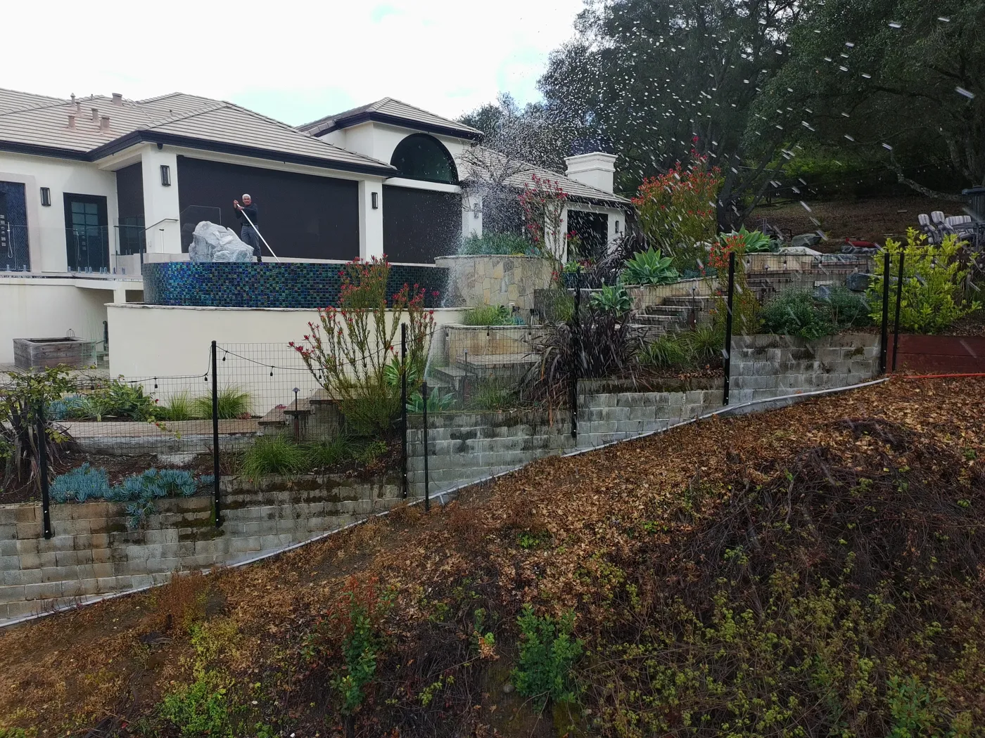
- Ember-resistant vents and enclosed eaves keep embers out of the attic
- A clear 5-foot zone around the house, with nothing that burns against the walls
- Noncombustible fencing and gates where they meet the house
- Photos and records of every upgrade for your insurer
Nearby Communities We Serve
FireRoofs also installs wildfire defense systems in neighboring communities with similar WUI risk profiles.
If You Lose the Home
What Losing a Clayton Home to Fire Actually Involves
Clayton sits directly below the chaparral slopes of Mount Diablo, and the 2013 Morgan Fire, which burned more than 3,100 acres on the mountain immediately above town, showed how quickly that terrain can carry fire toward residential streets. A total loss here would mean a recovery that takes years, not months.
$247/sq ft
Underinsurance Is Widespread
A year-one survey of 2025 Los Angeles wildfire households by United Policyholders found 69% reported being underinsured, short by an average of $247 per square foot. Clayton homeowners with older policies face the same structural risk of coverage that has not kept pace with construction costs.[1]
52%
Settlements Take Over a Year
More than a year after the 2017 Tubbs Fire, 52 percent of those who lost homes had still not settled with their insurance companies. A prolonged claims process leaves families in temporary housing while mortgage payments and living expenses continue.[2]
24+ months
Housing Coverage Has a Ceiling
California law requires at least 24 months of additional living expense coverage for losses in a declared state of emergency, plus up to 12 more months if rebuilding is delayed by contractor or permit shortages. Knowing your policy limits before a loss matters.[3]
“I have moved six times. And I’m going to have to move a seventh time. And there is nothing to rent.”
Keeping Home Insurance in Clayton
Homeowners in Clayton are facing surging FAIR Plan rates and non-renewals from private carriers. California's Safer from Wildfires rule requires admitted insurers to offer discounts for named mitigation, like a Class A roof, ember-resistant vents and a cleared first 5 feet. Exterior sprinklers are not one of the named measures. FireRoofs provides the engineering documentation and evidence packet designed to help you qualify for the voluntary market.
Clayton properties bordering the state park face high non-renewal rates.
Got a notice from your insurer? Here is what to do after a non-renewal.
Check Your Home's Wildfire Risk FreeNext Steps for Your Clayton Property
FireRoofs does not install in Clayton, but you can check your home's wildfire risk free. Enter your address to see your fire zone, your roof and the plants around your house.
Common Questions
What wildfire risk does Clayton face?
Clayton is designated a Very High Fire Hazard Severity Zone by CAL FIRE. Contra Costa County fire maps confirm extreme exposure driven by chaparral and annual grassland fuel loads and dry-season wind patterns. Dense, fire-adapted chaparral on the mountain slopes above Clayton carries intense, fast-moving fire toward the community.
Do exterior wildfire sprinklers qualify for an insurance discount in Clayton?
Exterior sprinklers are not one of the named Safer from Wildfires categories, so no carrier is required to discount for them. A documented FireRoofs project produces evidence for the categories that are named, such as ember-resistant vents, enclosed eaves and noncombustible fencing near the house. Discounts vary by carrier.