Menlo Park Wildfire Defense
Menlo Park's wildfire exposure is concentrated in its western neighborhoods. Sharon Heights, Las Lomitas, and the Stanford Hills area rise into the same foothills that connect to Woodside and Portola Valley, putting several hundred homes in direct contact with wildland vegetation. The Menlo Park Fire Protection District, which hosts California Task Force 3 Urban Search and Rescue, has been one of the more vocal Bay Area agencies about the growing WUI risk in foothill communities. They have deployed brush rigs and implemented a community education program specifically for the Sharon Heights and western Menlo Park homeowners who face the highest exposure.
$149 Wildfire Report for Menlo Park Homeowners
See what California wildfire codes require for your Menlo Park property. Covers roof, vents, defensible space, and insurance paperwork. Get your report in minutes.
CAL FIRE Risk Designation
San Mateo County
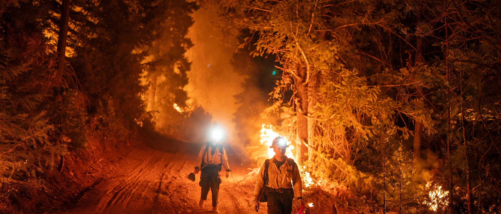
Sharon Heights and Las Lomitas in western Menlo Park sit in the same foothills that connect to Woodside and Portola Valley wildland.
FireRoofs Premier Home Hardening & Active Defense
FireRoofs provides premier wildfire defense and home hardening for Menlo Park properties. We combine automated exterior wildfire sprinkler systems with structural hardening that addresses every ember entry point on the home. Learn more about wildfire roof sprinkler installation and how it works alongside defensible space in Menlo Park.
Automated Exterior Sprinklers
Dual-detection roof and perimeter sprinklers with satellite monitoring
Ember-Resistant Vents
Retrofit vents that seal the attic from ember intrusion
Noncombustible Fencing
Eliminate the fence-to-structure flame path
Zone Zero Hardening
Clear combustible material within 5 feet of the structure
Vegetation Fire Retardant
Applied to surrounding landscape for ember resistance
Insurance Evidence Packet
Mapped to California Regulation 2644.9 for carrier submission
Menlo Park's western neighborhoods along the foothills face wildfire exposure from Jasper Ridge and surrounding open space. Properties in the Sharon Heights, Vintage Oaks, and foothills areas border grassland and oak woodland that create seasonal fire risk. FireRoofs provides hardening solutions designed for Menlo Park's established residential architecture and its proximity to wildland fuel.
EmberSafe Gutter Guard Installation in Menlo Park
Menlo Park foothills homes collect oak and eucalyptus debris in gutters from surrounding trees and nearby open space. During fire events, embers can travel from Jasper Ridge into residential areas. Our stainless steel micro mesh gutter guards keep gutters noncombustible and debris-free, a priority hardening measure recommended by Fire Safe San Mateo County for homes near the wildland interface.
Fire Safe San Mateo - Home HardeningEmber & Flame Resistant Vent Retrofit in Menlo Park
Menlo Park homes in the foothills area often have vent configurations that predate modern WUI standards. Vulcan Vents with ASTM E2886 certification and California State Fire Marshal listing provide ember and flame protection that exceeds minimum code requirements. The intumescent honeycomb technology in these vents seals vent openings under fire conditions, preventing ember intrusion into the attic or crawl space.
Vulcan Vents - WUI Code RequirementsNon Combustible Gate and Fence Installation in Menlo Park
Menlo Park properties commonly feature wood privacy fencing and entry gates that can carry fire from open space to the home. Our noncombustible gate and fence installation replaces wood components within the Zone 0 perimeter with aluminum or steel alternatives meeting ASTM E136 standards, eliminating the fence-to-structure fire bridge while maintaining the privacy and aesthetic standards Menlo Park homeowners require.
CA Dept of Insurance - Safer from WildfiresNon Combustible Deck Retrofit for Menlo Park Homes
Menlo Park properties with aging wood decks face ember ignition risk on one of the largest exposed surfaces of the home. Our deck retrofit replaces combustible decking with materials certified under SFM Standard 12-7A-4 that resist both ember landing and under-deck flame exposure. The result provides a fire-rated outdoor surface that meets San Mateo County WUI building requirements.
Fire Safe San Mateo - Deck ProtectionOpen Eave Enclosure for Menlo Park Residences
Menlo Park homes with open eave construction create direct pathways for wind-driven embers to enter the attic. Our retrofit encloses open eaves with noncombustible soffit material and WUI-rated vents that meet ASTM E2886 standards. This brings existing construction into compliance with California Building Code Chapter 7A for exterior wildfire exposure while maintaining the architectural integrity of Menlo Park homes.
CALBO - WUI Building StandardsWhy Home Hardening Matters in Menlo Park
Insurance carriers evaluate Menlo Park properties on a parcel-by-parcel basis. If your home is on the western edge near Sharon Heights or Las Lomitas, your risk profile looks very different from a home in central Menlo Park. Documented mitigation changes that evaluation
FireRoofs serves the western Menlo Park neighborhoods with both sprinkler systems and full hardening scopes. The evidence packet gives your insurer or broker a property-specific documentation package that reflects exactly what has been done.

CAL FIRE Very High Fire Hazard Severity Zones (VHFHSZ) shown in red/orange
Source: CAL FIRE Fire Hazard Severity Zone data via Bay Area News Group
CAL FIRE High Fire Hazard Severity Zone
Portions of western Menlo Park fall within High to Very High FHSZ. Most of the city core is Moderate or not designated. Updated per 2025 CAL FIRE maps. Local Responsibility Area.
Menlo Park's Wildfire Record
Understanding past fires helps predict future risk. Here are the most significant fire events near Menlo Park.
The Edgewood Fire in nearby Woodside triggered evacuations in western Menlo Park, demonstrating that wildfire is not just a hillside problem for this community.
No major wildfire has burned into Menlo Park in recent decades. Some small brush fires in surrounding hills. Smoke and ember exposure from regional wildfire events.
Local Risk Factors
West Menlo Park WUI
West Menlo Park (unincorporated San Mateo County) and western edges adjacent to Woodside foothills face direct wildland-urban interface exposure with wildland-transition vegetation.
Dense Mature Canopy
Residential tree canopy with oaks, eucalyptus, redwoods, and ornamental species creates ember vulnerability, particularly in Sharon Heights and Las Lomitas neighborhoods.
Upwind Foothill Exposure
Peninsula Watershed lands and Woodside foothills sit upwind. Fires in adjacent foothills could push embers into Menlo Park during Diablo wind events.
High Property Values
Sharon Heights, Las Lomitas, and West Menlo Park homes commonly exceed $3M-$5M, with luxury homes frequently $5M-$15M+, creating significant FAIR Plan gaps.
Book a free on-site evaluation. We will design and install the right sprinkler and hardening system for your home.
Book Free EvaluationAll work performed by licensed and insured contractors.
Get the $149 assessment report. Find out what wildfire risk models flag on your property. Results in minutes.
Get $149 ReportMenlo Park Fire Environment
Vegetation Types
Wind Patterns
Moderate Diablo wind exposure; ember transport from adjacent foothills during offshore wind events
Topography
City core is flat valley floor. Western portions (Sharon Heights, Las Lomitas, West Menlo Park) have hillside exposure with rolling terrain transitioning to Woodside foothills.
Fire District
Menlo Park Fire Protection District
Insurance Impact
Menlo Park home values vary widely. West Menlo Park luxury homes frequently exceed $5M-$15M+, far exceeding the $3M FAIR Plan cap. Properties in WUI-adjacent western areas face growing insurance challenges.
Protecting Your Menlo Park Home & Family
Living in a fire-prone area means being proactive. Here are the steps every Menlo Park homeowner should take to protect their property and prepare for wildfire season.
Evacuation Planning
Good evacuation infrastructure via El Camino Real, Sand Hill Road, Alpine Road, Middlefield Road, US-101, and I-280. Sand Hill Road provides key access to Stanford and I-280. Register for SMC Alert emergency notifications.
Defensible Space
Maintain 100 feet of defensible space. Western Menlo Park faces more direct defensible space requirements. Focus on ember-resistant measures: clear roofs, gutters, and under-deck areas. MPFPD provides inspections and education in WUI portions of the service area.


Your Local Fire Safe Council
FIRE SAFE San Mateo County
The FIRE SAFE San Mateo County offers free resources, community chipping programs, home assessments, and education to help Menlo Park residents reduce wildfire risk and prepare for fire season.
Visit FIRE SAFE San Mateo CountyMenlo Park Wildfire Preparedness Resources
Menlo Park Fire Protection District
Community Risk Reduction Bureau programs, wildfire preparedness education, and inspection services.
MPFPDFIRE SAFE San Mateo County
Chipper programs, home hardening guides, and fire-safe landscaping information.
Fire Safe San MateoCAL FIRE Defensible Space Guide
Official California guide to creating defensible space zones around your property.
CAL FIREProtect Your Menlo Park Home with FireRoofs
Defensible space and evacuation planning are essential, but they have limits. When embers are raining down and flames are approaching, your home needs both an automated active defense system and structural hardening that eliminates every ember entry point.
FireRoofs combines automated exterior sprinkler systems with structural home hardening for Menlo Park properties. Our Detect → Alert → Defend system uses intelligent wildfire detection cameras, satellite monitoring, and high-pressure water to saturate your property. Our hardening scope seals every vulnerability embers exploit.
- Automated exterior sprinklers: roof and perimeter coverage with dual detection
- Ember-resistant vent retrofits to seal the attic from intrusion
- Noncombustible fencing to eliminate the fence-to-structure flame path
- Zone Zero landscape hardening within 5 feet of the structure
- Vegetation fire retardant application for surrounding landscape
- Class A firefighting foam add-on: 100% biodegradable, non-toxic, rinses off through sprinklers
- Insurance evidence packet documenting all upgrades, mapped to California Regulation 2644.9


Local Wildfire Resources for Menlo Park Homeowners
Rules and requirements can change. Verify current requirements with your city or fire district before taking action.

Tree Removal and Defensible Space Rules
Menlo Park's Heritage Tree Ordinance protects mature trees. Permits required for removal. Exemptions available for fire hazard and dead/dying trees. Follows San Mateo County tree standards with local amendments.
Fire Hazard Severity Zone: Portions of western Menlo Park fall within High to Very High FHSZ. Most of the city core is Moderate or not designated. Updated per 2025 CAL FIRE maps. Local Responsibility Area.

Free Programs for Menlo Park Homeowners
- MPFPD community education and inspections in WUI areas
- San Mateo County Fire Safe Council programs (firesafesanmateo.org)
- Access to regional chipper programs
Your Fire District
Menlo Park Fire Protection District (MPFPD)
Community Designations
- Firewise USA potential in western hillside neighborhoods
- Part of San Mateo County Fire Safe Council
Community designations like Firewise USA and Fire Risk Reduction Community may qualify homeowners for insurance benefits under California's Safer from Wildfires regulation.

Statewide Zone 0 Compliance Timeline
Board of Forestry rulemaking targeted for completion by December 31, 2025. New construction: compliance begins once rules are adopted (projected 2026). Existing structures: 3-year phase-in (compliance expected by approximately 2028-2029).
State Defensible Space (PRC 4291)
Zone 0: 0-5 feet, ember-resistant/noncombustible. Zone 1: 5-30 feet, lean, clean, and green. Zone 2: 30-100 feet, reduced fuel loading. Annual compliance inspections by local fire districts during fire season.
California Building Code
Effective 2026, California Wildland-Urban Interface Code (CWUIC) Part 7 replaces CBC Chapter 7A. Applies to new construction in designated fire hazard zones.
How FireRoofs Fits In
Understanding your local requirements is the first step. A FireRoofs automated defense system works alongside your defensible space, home hardening, and community efforts to give your home the strongest possible protection. During your free property evaluation, our team reviews your property in the context of Menlo Park's specific requirements and helps you understand how active defense fits into your overall wildfire strategy.
Nearby Communities We Serve
FireRoofs also installs wildfire defense systems in neighboring communities with similar WUI risk profiles.
2026 Insurance Alert for Menlo Park Homeowners
Homeowners in Menlo Park are facing surging FAIR Plan rates and non-renewals from private carriers. California's Safer from Wildfires framework now requires participating insurers to offer discounts for documented mitigation systems. FireRoofs provides the engineering documentation and evidence packet designed to help you qualify for the voluntary market.
California's SB 429 (effective January 1, 2026) establishes the nation's first public wildfire catastrophe model, giving homeowners new tools to understand insurance risk scores. Ask HydroIQ what this means for Menlo Park homeowners.
Request a Free Property EvaluationAsk HydroIQ About Menlo Park - Free AI Wildfire Assistant
Get instant answers about Menlo Park's wildfire risk level, defensible space requirements, fire history, FAIR Plan insurance options, and how exterior sprinkler systems can protect your home. HydroIQ covers communities across all nine Bay Area counties.
Protect Your Menlo Park Property Today
Every Menlo Park property is different. Get a free evaluation of your home's wildfire exposure and a custom defense plan.
Common Questions
What wildfire risk does Menlo Park face?
Menlo Park is designated a High fire risk zone by CAL FIRE. San Mateo County fire maps confirm elevated exposure driven by coast live oak and eucalyptus fuel loads and seasonal offshore winds. West Menlo Park (unincorporated San Mateo County) and western edges adjacent to Woodside foothills face direct wildland-urban interface exposure with wildland-transition vegetation.
How does FireRoofs protect Menlo Park homes from wildfire?
FireRoofs provides both active defense and passive home hardening for Menlo Park properties. Active defense includes automated exterior sprinkler systems with dual detection, satellite monitoring, and intelligent fire detection cameras. Passive hardening covers ember-resistant vent retrofits, noncombustible fencing, Zone Zero landscape hardening, exterior cladding upgrades, and vegetation fire retardant. Every upgrade is documented in one evidence packet mapped to California Regulation 2644.9 for insurance recognition.
What does home hardening include for a Menlo Park property?
Home hardening for Menlo Park properties addresses every ember entry point on the structure. FireRoofs performs ember-resistant vent installation, noncombustible fencing replacement, eave and soffit sealing, Zone Zero landscape clearance within 5 feet of the structure, vegetation fire retardant application, and exterior cladding upgrades where needed. Scope is determined during a free property evaluation and accounts for site-specific conditions including lot size and exposure. All work is documented for insurance submission.
Where can I get instant answers about Menlo Park's wildfire risk?
HydroIQ is FireRoofs' free wildfire assistant that provides instant, city-specific answers about Menlo Park's fire hazard zone classification, defensible space requirements, local fire history, FAIR Plan insurance options, and wildfire defense systems. No sign-up required. Visit fireroofs.com/hydroiq to learn more or ask a question directly.
What is California home hardening?
California home hardening is the process of retrofitting a structure to resist wildfire ember intrusion and radiant heat exposure. It includes replacing combustible building materials, sealing openings such as attic vents and eaves, installing noncombustible fencing, clearing the Zone Zero perimeter within 5 feet of the structure, and applying fire-resistant treatments. Home hardening is one of the 12 mitigation categories under California Regulation 2644.9 (Safer from Wildfires) that participating insurers must recognize when setting premiums.
How do I get off the California FAIR Plan?
To transition from the California FAIR Plan back to the voluntary insurance market, homeowners need to demonstrate documented wildfire risk reduction. This includes property-level mitigation such as home hardening, automated exterior sprinkler systems, and defensible space maintenance. Under California Regulation 2644.9, admitted insurers are required to offer premium discounts for documented mitigation across 12 categories. FireRoofs provides the upgrades and the evidence packet that documents each improvement for your insurer or broker.
What are the 12 Safer from Wildfires mitigation categories?
California Regulation 2644.9 defines 12 mitigation categories that insurers must recognize: (1) Class A fire-rated roof, (2) Enclosed eaves, (3) Ember-resistant vents, (4) Exterior wall cladding, (5) Dual-pane or tempered windows, (6) Noncombustible fencing within 5 feet, (7) Defensible space Zone 0-2 maintained, (8) Community-level mitigation (Fire Risk Reduction Community), (9) Active fire defense system such as exterior sprinklers, (10) Fire-resistant landscaping, (11) Access and water supply, (12) Structure-specific risk reduction. FireRoofs addresses categories 1 through 10 directly.
Do exterior roof sprinklers qualify for insurance discounts in California?
Yes. Automated exterior sprinkler systems are recognized under Category 9 (Active Fire Defense System) of California Regulation 2644.9. When documented in an evidence packet and submitted to your insurer, they count toward the mitigation credits that admitted carriers are required to apply. FireRoofs installs dual-detection exterior sprinkler systems and provides the documentation package for insurance recognition. SB 429 (effective January 1, 2026) further supports this by establishing a public wildfire catastrophe model that factors documented improvements into risk scoring.
Which parts of Menlo Park face wildfire risk?
West Menlo Park, Sharon Heights, and Las Lomitas neighborhoods have the most wildfire exposure due to proximity to Woodside foothills. The city core is generally low-risk. The 2022 Edgewood Fire in nearby Woodside triggered evacuations in western Menlo Park.
What fire district serves Menlo Park?
The Menlo Park Fire Protection District (MPFPD) serves Menlo Park, Atherton, East Palo Alto, and parts of unincorporated San Mateo County. MPFPD hosts California Task Force 3 (CA-TF3) Urban Search and Rescue team.
Are there free wildfire programs for Menlo Park homeowners?
Yes. MPFPD provides community education and inspections in WUI areas. The San Mateo County Fire Safe Council at firesafesanmateo.org offers chipper programs and home hardening resources.