Walnut Creek Wildfire Protection: Fire Zone, Insurance and Home Hardening
Walnut Creek is surrounded by wildland on three sides. Mount Diablo rises to the east, the Briones Hills line the north, and the Las Trampas Ridge flanks the west. These open spaces make Walnut Creek one of the most desirable communities in the East Bay, but they also make it one of the most fire-exposed. Neighborhoods in Northgate, Shell Ridge, and Saranap back directly onto dry grassland and oak woodland. The Morgan Fire in 2013 burned 3,111 acres on the slopes of Mount Diablo, visible from every hillside neighborhood in Walnut Creek.
CAL FIRE Risk Designation
Contra Costa County
Shell Ridge and Lime Ridge: Fires Inside the City
Walnut Creek's open space reaches deep into its neighborhoods. On June 11, 2010, a four-alarm grass fire in the Shell Ridge Open Space burned about 180 acres and came within 10 to 20 feet of play structures at Indian Valley Elementary School. No homes were damaged, and a voluntary evacuation alert was later canceled.
On June 29, 2018, a wind-driven grass fire in the Lime Ridge Open Space near the Concord border burned 268 acres. Homes in Concord's Crystyl Ranch and Montecito neighborhoods were evacuated, and parts of Walnut Creek and Concord were told to shelter in place. Investigators traced it to a vehicle on Ygnacio Valley Road. Lime Ridge burned again on September 30, 2024, about 5 to 10 acres, stopped within roughly an hour.
Contra Costa County Fire and the 2025 Hazard Maps
Walnut Creek is served by the Contra Costa County Fire Protection District (ConFire). ConFire held a district-wide community meeting on April 1, 2025, and its updated Local Responsibility Area fire hazard maps took effect July 10, 2025. The district did not add any areas beyond the state's recommendations.
ConFire publishes a Walnut Creek LRA map PDF on cccfpd.org so you can check your parcel.
Getting Out Along Ygnacio Valley Road
Ygnacio Valley Road is the main route past Lime Ridge and Shell Ridge, and the 2018 fire started beside it. Contra Costa County sends alerts through its Community Warning System and maps evacuation zones on Genasys Protect. The Diablo Fire Safe Council serves the county with fuel reduction projects and grant information.
Walnut Creek Fire Protection Resources
Fire Hazard Zone Lookup
Check whether your Walnut Creek address is in a Very High, High, or Moderate Fire Hazard Severity Zone using CAL FIRE 2025 maps.
Look up your addressEvacuation Map
Contra Costa County evacuation zones, routes, and real-time status during active incidents.
Contra Costa County Evacuation Map (Genasys Protect)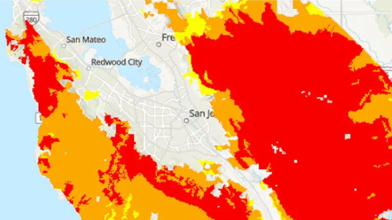
CAL FIRE Very High Fire Hazard Severity Zones (VHFHSZ) shown in red/orange
Source: CAL FIRE Fire Hazard Severity Zone data via Bay Area News Group
CAL FIRE VHFHSZ Designation
Very High and High FHSZ on hillside neighborhoods bordering Mount Diablo, Shell Ridge, and Briones Regional Park. Updated per 2025 CAL FIRE maps.
Walnut Creek's Wildfire Record
Understanding past fires helps predict future risk. Here are the most significant fire events near Walnut Creek.
Burned 3,111 acres on the north slope of Mount Diablo, visible from Walnut Creek neighborhoods. Driven by hot, dry conditions.
Burned in the Diablo Range south and east of Walnut Creek. Evacuation warnings were issued for eastern Contra Costa County.
Local Risk Factors
Mount Diablo Fire Corridor
Eastern Walnut Creek backs directly onto Mount Diablo State Park, one of the most fire-prone wildland areas in the East Bay.
Three-Sided Wildland Exposure
Walnut Creek is bordered by wildland on its north (Briones), east (Diablo), and west (Las Trampas) edges.
Diablo Wind Events
Hot, dry Diablo winds funnel through local canyons, rapidly drying vegetation and driving fire toward residential areas.
Live fire status near Walnut Creek
Track active incidents, Red Flag Warnings, air quality, PSPS power shutoffs, and evacuation resources for the Contra Costa County area, updated throughout the day.
Walnut Creek Fire Environment
Vegetation Types
Wind Patterns
Significant Diablo wind exposure; canyon channeling from the east; multiple Red Flag Warning events per season
Topography
Valley floor at 130 feet rising to 3,849 feet at Mount Diablo summit. Steep terrain on all hillside edges.
Protecting Your Walnut Creek Home & Family
Living in a fire-prone area means being proactive. Here are the steps every Walnut Creek homeowner should take to protect their property and prepare for wildfire season.
Evacuation Planning
Know routes to I-680 and Highway 24. Shell Ridge and Northgate neighborhoods have limited hillside egress. Register for CoCo Alert.
Defensible Space
Hillside properties require 100 feet of defensible space. The Diablo Firesafe Council offers cost-share matching for defensible space work.
Your Local Fire Safe Council
Diablo Firesafe Council
Walnut Creek Wildfire Preparedness Resources
Protect Your Walnut Creek Home with FireRoofs
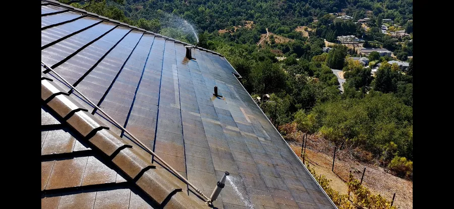
- Ember-resistant vents, enclosed eaves and noncombustible fencing
- Zone 0 hardening within 5 feet of the house
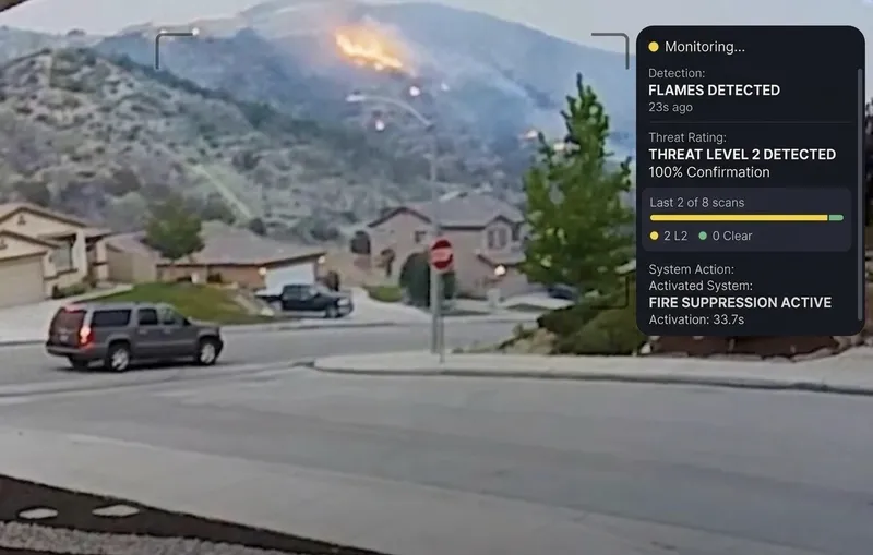
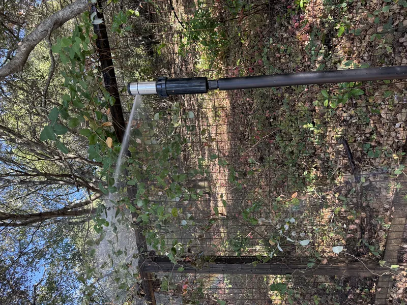
- Automated exterior sprinklers for roof and perimeter
- One insurance documentation packet for every upgrade
Nearby Communities We Serve
FireRoofs also installs wildfire defense systems in neighboring communities with similar WUI risk profiles.
If You Lose the Home
A Total Loss in Walnut Creek: The Long Road Back
The Morgan Fire burned 3,111 acres on Mount Diablo's north slope in 2013, visible from neighborhoods throughout Walnut Creek, and the SCU Lightning Complex in 2020 pushed evacuation warnings into eastern Contra Costa County. With the Briones Hills, Las Trampas Ridge, and Mount Diablo surrounding the city on three sides, a fire reaching Walnut Creek's hillside neighborhoods would be a regional event, not a local one. What that means for recovery is illustrated by what happened to homeowners in Oakland and Santa Rosa.
$1.5 billion
Large Fires Expose Policy Gaps Fast
The 1991 Oakland hills firestorm destroyed more than 3,300 single-family homes and caused losses exceeding $1.5 billion, and homeowners discovered their insurance coverage had significant gaps. A fire of comparable scale touching Walnut Creek's hillside neighborhoods would create the same pressure on an already strained regional insurance market.[1]
$600/sq ft
Rebuild Costs Surge After Regional Fires
After the 2017 Tubbs Fire, reconstruction expenses in Santa Rosa reached nearly $600 per square foot within the following year. Walnut Creek homeowners whose policies were written against pre-disaster construction costs would face that same kind of shortfall in a post-fire regional market.[2]
7 moves
Displacement Stretches On and On
A year after the 2017 fires, Napa homeowner Stuart Funk told state lawmakers he had moved six times and was facing a seventh move, with nothing left to rent nearby. That level of displacement is common when an entire region's housing stock is affected at once.[2]
“Dealing with the insurance company was probably just as bad as the fire.”
Keeping Home Insurance in Walnut Creek
Walnut Creek homes that back onto Shell Ridge, Lime Ridge or other open space are where underwriters look hardest. Keep your parcel zone from the ConFire map, your defensible space records and dated photos of your hardening work together.
California regulation 10 CCR 2644.9 requires insurers to recognize listed mitigation and to re-rate after you document it. FireRoofs documents every upgrade in one packet for your broker.
Got a notice from your insurer? Here is what to do after a non-renewal.
Contact UsProtect Your Walnut Creek Property Today
Every Walnut Creek property is different. FireRoofs does not install here, but tell us about your home and we will point you to the right next step.
Common Questions
What wildfire risk does Walnut Creek face?
Walnut Creek is designated a Very High Fire Hazard Severity Zone by CAL FIRE. Contra Costa County fire maps confirm extreme exposure driven by annual grassland and blue oak woodland fuel loads and dry-season wind patterns. Eastern Walnut Creek backs directly onto Mount Diablo State Park, one of the most fire-prone wildland areas in the East Bay.
Do exterior wildfire sprinklers qualify for an insurance discount in Walnut Creek?
Exterior sprinklers are not one of the named Safer from Wildfires categories, so no carrier is required to discount for them. A documented FireRoofs project produces evidence for the categories that are named, such as ember-resistant vents, enclosed eaves, defensible space and a noncombustible Zone 0. Discounts vary by carrier.