East Bay Hills Wildfire Protection: Fire Zone, Insurance and Home Hardening
The 1991 Oakland Hills Tunnel Fire killed 25 people, destroyed 2,843 single-family homes, and caused $1.5 billion in damage in a matter of hours. It remains the most destructive urban-wildland fire in Bay Area history. The fire started in the same eucalyptus groves and Monterey pine plantations that still stand today along Grizzly Peak Boulevard, Fish Ranch Road, and Tunnel Road. Despite 35 years of vegetation management and building code improvements, fire scientists say the same conditions that created the 1991 firestorm, Diablo winds, low humidity, and continuous eucalyptus canopy, still exist across the East Bay ridgeline from El Cerrito to Fremont.
CAL FIRE Risk Designation
Alameda / Contra Costa County

The 1991 Oakland Hills Tunnel Fire destroyed 2,843 homes and killed 25 people. The same eucalyptus groves and wind conditions still exist along the East Bay ridgeline today.
East Bay Hills Fire Protection Resources
Fire District
Oakland, Berkeley, and Moraga-Orinda Fire Districts
Fire Hazard Zone Lookup
Check whether your East Bay Hills address is in a Very High, High, or Moderate Fire Hazard Severity Zone using CAL FIRE 2025 maps.
Look up your addressEvacuation Map
Alameda / Contra Costa County evacuation zones, routes, and real-time status during active incidents.
Alameda / Contra Costa County Evacuation Map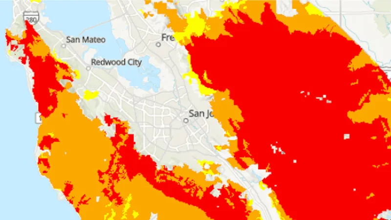
CAL FIRE Very High Fire Hazard Severity Zones (VHFHSZ) shown in red/orange
Source: CAL FIRE Fire Hazard Severity Zone data via Bay Area News Group
CAL FIRE VHFHSZ Designation
Significant portions of the East Bay Hills corridor are designated VHFHSZ by CAL FIRE, representing one of the highest concentrations of urban wildfire risk in California.
East Bay Hills's Wildfire Record
Understanding past fires helps predict future risk. Here are the most significant fire events near East Bay Hills.
Killed 25 people, destroyed 2,843 homes, and caused $1.5 billion in damage, making it one of the worst WUI fires in U.S. history.
Burned 3,111 acres on Mount Diablo, threatening communities from Danville to Walnut Creek.
While centered in Napa/Sonoma, the fires demonstrated the catastrophic potential of Diablo wind-driven urban-wildland fires.
Local Risk Factors
1991 Fire Legacy
Despite rebuilding, many of the same conditions that caused the Tunnel Fire remain: dense vegetation, steep terrain, Diablo winds, and narrow roads.
Dense Urban-Wildland Interface
Tens of thousands of homes are built directly into fire-prone hillside vegetation with minimal defensible space.
Extreme Diablo Wind Exposure
The hills are the first terrain feature that hot, dry Diablo winds hit after crossing the Central Valley, creating extreme fire conditions.
Eucalyptus Forests
Extensive eucalyptus plantations produce massive ember showers and burn with extraordinary intensity.
Live fire status near East Bay Hills
Track active incidents, Red Flag Warnings, air quality, PSPS power shutoffs, and evacuation resources for the Alameda / Contra Costa County area, updated throughout the day.
Request a private consultation. We will design and install the right sprinkler and hardening system for your home.
Request a Private ConsultationEast Bay Hills Fire Environment
Vegetation Types
Wind Patterns
Extreme Diablo wind corridor; tunnel effects through canyons
Topography
Elevation 200-1,900 ft. Steep, deeply-canyoned terrain with dense development.
Protecting Your East Bay Hills Home & Family
Living in a fire-prone area means being proactive. Here are the steps every East Bay Hills homeowner should take to protect their property and prepare for wildfire season.
Evacuation Planning
The 1991 Oakland Hills fire killed 25 people and destroyed 3,000+ homes in hours. East Bay Hills neighborhoods have narrow, winding streets that gridlock during evacuations. Know multiple exit routes, register for AC Alert (Alameda) or CWS (Contra Costa), and leave at the first warning.
Defensible Space
Eucalyptus, Monterey pine, and dried grass create extreme fire conditions in the East Bay Hills. Remove eucalyptus bark buildup around trees near structures. The Diablo Fire Safe Council offers cost-sharing programs and the East Bay Regional Park District conducts fuel reduction on adjacent parkland.
Your Local Fire Safe Council
Diablo Fire Safe Council
East Bay Hills Wildfire Preparedness Resources
Diablo Fire Safe Council
Up to $3,500 in cost-sharing for vegetation clearing, Firewise community support, and education programs.
Diablo FSCDiablo Fire Safe Council Programs
Community programs, cost-sharing for vegetation clearing, and Firewise support for East Bay Hills.
Diablo Fire Safe CouncilCAL FIRE Wildfire Action Plan
Create a personalized wildfire action plan for your family and property.
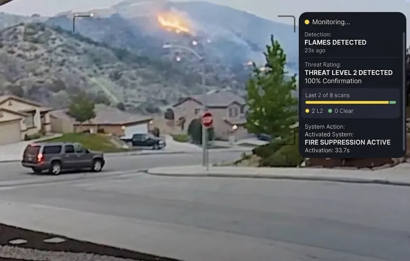
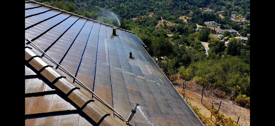
CAL FIREProtect Your East Bay Hills Home with FireRoofs
- Ember-resistant vents, enclosed eaves and noncombustible fencing
- 5-foot zone and vegetation work referred to trusted Tree & Vegetation partners
- Automated exterior sprinklers for roof and perimeter
- One insurance documentation packet for every upgrade
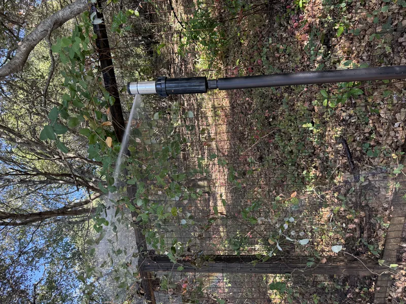
Local Wildfire Resources for East Bay Hills Homeowners
Rules and requirements can change. Verify current requirements with your city or fire district before taking action.
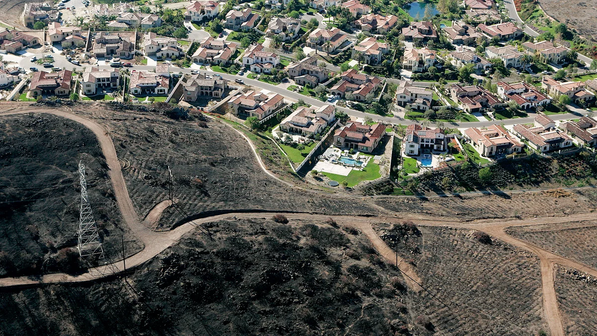
Tree Removal and Defensible Space Rules
Varies by municipality. Oakland requires vegetation management plans in the Hills Fire Zone. Berkeley has specific eucalyptus and Monterey pine removal programs. All follow PRC 4291 defensible space requirements.
Fire Hazard Severity Zone: Very High. Local Responsibility Area.
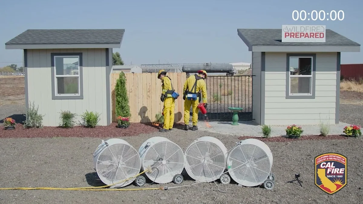
Free Programs for East Bay Hills Homeowners
- Diablo Fire Safe Council programs
- City-specific chipper and vegetation management programs
Community Designations
- Multiple Firewise USA neighborhoods in Oakland and Berkeley hills
Community designations like Firewise USA and Fire Risk Reduction Community may qualify homeowners for insurance benefits under California's Safer from Wildfires regulation.
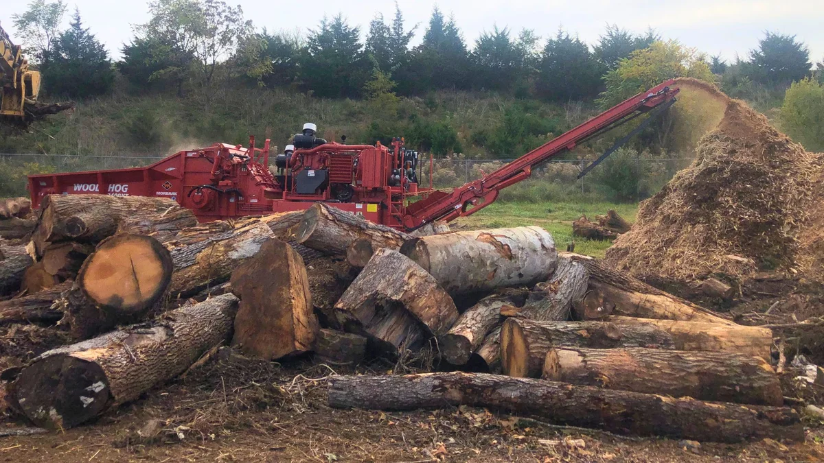
Nearby Communities We Serve
FireRoofs also installs wildfire defense systems in neighboring communities with similar WUI risk profiles.
If You Lose the Home
What East Bay Hills Homeowners Face After a Total Loss
The 1991 Oakland Hills Tunnel Fire erased entire neighborhoods in hours, and the eucalyptus groves and Diablo wind patterns that drove it are still here. A total loss today would drop survivors into an insurance and rebuilding process that has blindsided homeowners in every major California fire since. Knowing what that process looks like is worth understanding before fire season arrives.
$1.5 billion
Insurance Gaps Exposed by Oakland Fire
The 1991 Oakland hills firestorm destroyed more than 3,300 single-family homes and caused losses exceeding $1.5 billion. What followed revealed that many homeowners' policies had serious shortfalls they had not anticipated.[1]
4 years
IRS Deadline Extended After Oakland Disaster
After the 1991 Oakland fire, rebuilding materials were so scarce that Congress extended the IRS window before insurance proceeds become taxable from two years to four for federally declared disasters. East Bay Hills homeowners should understand that timeline exists because recovery here took that long.[1]
80+ pages
Contents Inventory Becomes Full-Time Work
After the 2017 Napa and Sonoma fires, one attorney described documenting losses as a second full-time job, and homeowners reported contents inventories running 80 pages or more. Survivors in any major fire face this burden while also managing temporary housing and contractor searches.[2]
“If you are underinsured, they’ll be off the hook.”
Keeping Home Insurance in East Bay Hills
Homeowners in East Bay Hills are facing surging FAIR Plan rates and non-renewals from private carriers. California's Safer from Wildfires framework now requires participating insurers to offer discounts for documented mitigation systems. FireRoofs provides the engineering documentation and evidence packet designed to help you qualify for the voluntary market.
East Bay Hills has the longest history of insurance challenges in the Bay Area, with non-renewals escalating since the 2017 North Bay fires.
Got a notice from your insurer? Here is what to do after a non-renewal.
Request a Private ConsultationProtect Your East Bay Hills Property Today
Every East Bay Hills property is different. Request a private consultation of your home's wildfire exposure and a custom defense plan.
Common Questions
What wildfire risk does East Bay Hills face?
East Bay Hills is designated a Very High Fire Hazard Severity Zone by CAL FIRE. Alameda / Contra Costa County fire maps confirm extreme exposure driven by eucalyptus forest and monterey pine fuel loads and dry-season wind patterns. Despite rebuilding, many of the same conditions that caused the Tunnel Fire remain: dense vegetation, steep terrain, Diablo winds, and narrow roads.
Do exterior wildfire sprinklers qualify for an insurance discount in East Bay Hills?
Exterior sprinklers are not one of the named Safer from Wildfires categories, so no carrier is required to discount for them. A documented FireRoofs project produces evidence for the categories that are named, such as ember-resistant vents, enclosed eaves and noncombustible fencing near the house. Discounts vary by carrier.
What wildfire defense programs are available in the East Bay Hills?
Programs vary by municipality. Oakland, Berkeley, and surrounding communities offer vegetation management programs and chipper services. The Diablo Fire Safe Council coordinates regional programs. Multiple neighborhoods hold Firewise USA recognition.
What defensible space rules apply in the East Bay Hills?
All East Bay Hills communities follow state PRC 4291 defensible space requirements. Oakland requires vegetation management plans in the Hills Fire Zone. Berkeley has specific eucalyptus and Monterey pine removal programs. Contact your local fire department for jurisdiction-specific rules.