Castro Valley Wildfire Protection: Fire Zone, Insurance and Home Hardening
Castro Valley is an unincorporated Alameda County community that sits directly below the East Bay hills where the 1991 Tunnel Fire demonstrated the worst-case WUI scenario. The Five Canyons, Palomares Hills, and Crow Canyon neighborhoods climb into the same eucalyptus-studded hills that burned in Oakland. What makes Castro Valley's risk profile distinct is the eucalyptus. East Bay Regional Park District lands adjacent to Castro Valley contain some of the densest non-native eucalyptus groves in the region. Eucalyptus bark strips can carry embers more than a mile ahead of a fire front, making traditional defensible space distances insufficient.
CAL FIRE Risk Designation
Alameda County
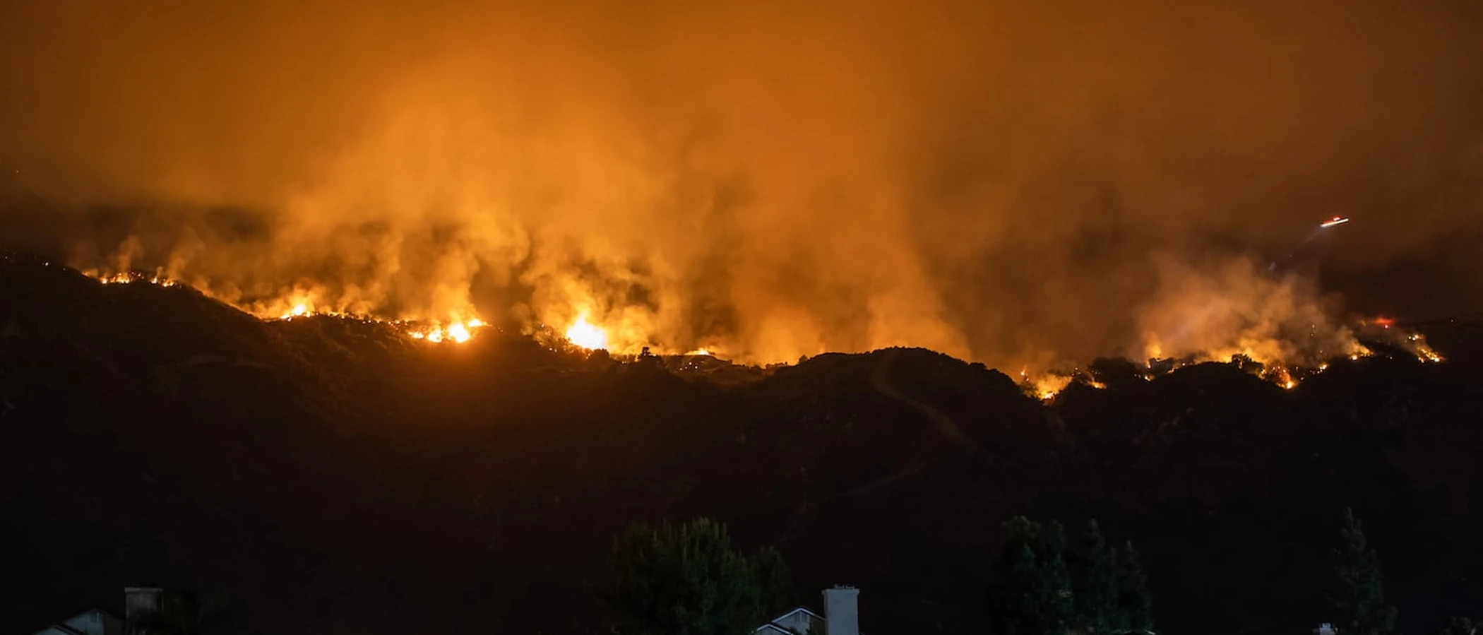
Castro Valley's hillside neighborhoods sit below the same East Bay hills eucalyptus groves that fueled the 1991 Oakland Tunnel Fire.
Where Castro Valley Burns: Canyons, Ridges and Grassland
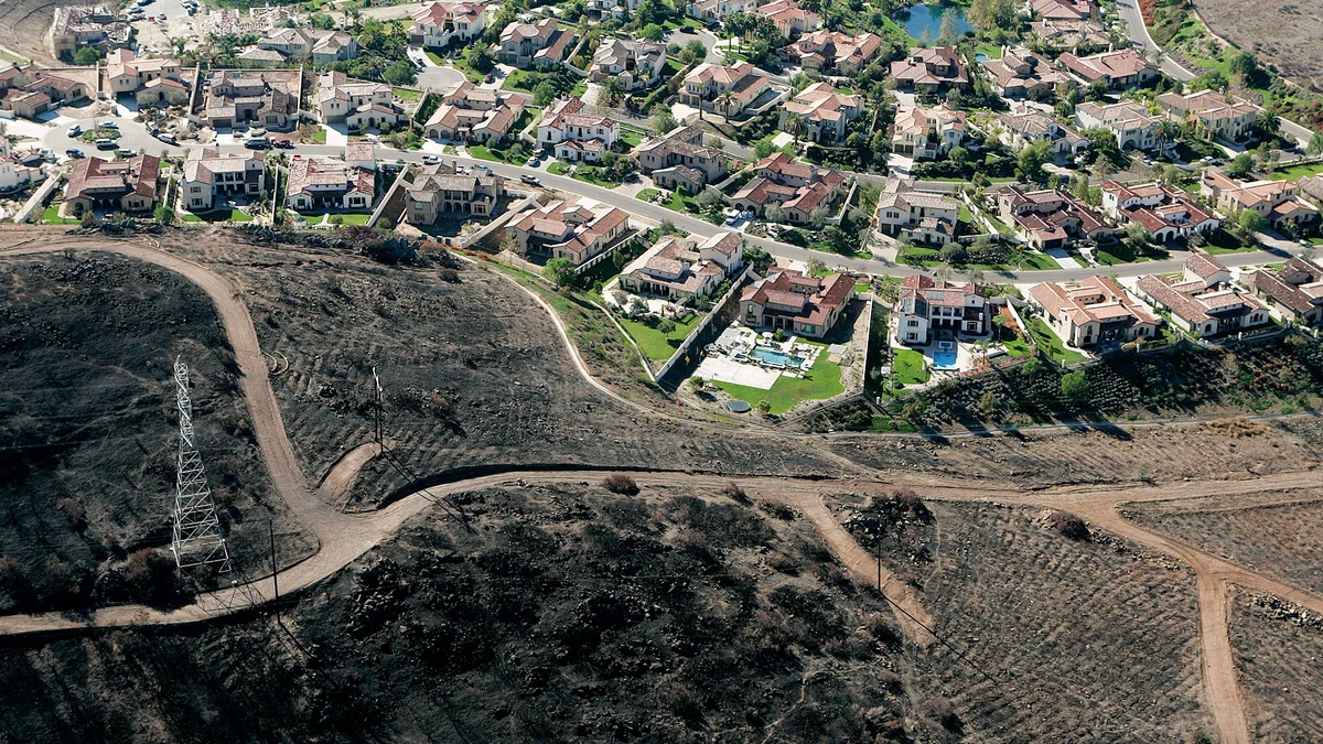
Castro Valley is unincorporated Alameda County, so there is no city hall or city fire department. The wildland edge runs through the canyon neighborhoods: Five Canyons and Palomares Canyon are both treated as wildland-urban interface areas, where homes sit on slopes above dry grass and oak woodland that cures by early summer.
Crow Canyon Road is the other corridor to watch. On September 17, 1965, a brush fire near the base of Crow Canyon Road threatened homes on Crow Canyon and Jensen roads. In July 2026 the Crow Fire, near Crow Canyon Road and Norris Canyon Road, burned 3 to 4 acres before crews stopped it, with no structures threatened and no injuries.
Alameda County Fire Department and the 2025 Hazard Maps
Fire protection comes from the Alameda County Fire Department (ACFD). On February 24, 2025 the State Fire Marshal released new Local Responsibility Area fire hazard maps, and the ACFD Board took up adoption at its May 13, 2025 meeting. The new maps show fewer Very High areas in unincorporated Castro Valley than the old ones, so a parcel that was Very High before may have moved, and the reverse can also happen.
Look up your own parcel with the ACFD Hazard Locator at fire.acgov.org/hazard-locator. ACFD runs annual parcel inspections in Very High zones and real estate transfer inspections in High and Very High zones, so the zone on your parcel affects both yearly upkeep and any future sale.
Getting Out: I-580 and the Canyon Roads
Interstate 580 runs along the south and east edge of town and has carried its own fires. On August 15, 2022 the Eden Fire started on I-580 east of Eden Canyon Road and burned 58 acres, and Dublin issued evacuation warnings for homes west of Schaefer Ranch Road. Canyon neighborhoods often have one main road out, so learn a second route before fire season and sign up for county alerts.
The Diablo Fire Safe Council serves Alameda and Contra Costa counties and publishes local maps and project information at diablofiresafe.org.
Castro Valley Fire Protection Resources
Fire Hazard Zone Lookup
Check whether your Castro Valley address is in a Very High, High, or Moderate Fire Hazard Severity Zone using CAL FIRE 2025 maps.
Look up your addressEvacuation Map
Alameda County evacuation zones, routes, and real-time status during active incidents.
Alameda County Evacuation Map (Genasys Protect)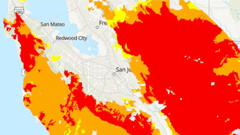
CAL FIRE Very High Fire Hazard Severity Zones (VHFHSZ) shown in red/orange
Source: CAL FIRE Fire Hazard Severity Zone data via Bay Area News Group
CAL FIRE High Fire Hazard Severity Zone
Very High and High FHSZ in hillside and canyon areas. 2025 CAL FIRE maps expanded zones. Local Responsibility Area with some State Responsibility Area edges.
Castro Valley's Wildfire Record
Understanding past fires helps predict future risk. Here are the most significant fire events near Castro Valley.
The Canyon Zone of the SCU Lightning Complex affected Alameda County hills adjacent to Castro Valley. The community experienced evacuations and heavy smoke impacts.
Multiple small brush fires have affected Castro Valley hills over the years. Eucalyptus-dominated EBRPD parklands have been fuel reduction focus areas.
Local Risk Factors
Eucalyptus Fire Risk
Significant eucalyptus groves on EBRPD parklands adjacent to residential areas pose particular concern due to high ember production and extreme fire intensity.
Canyon Fire Pathways
Five Canyons, Palomares, Crow Canyon, and upper Castro Valley Boulevard create natural fire pathways from wildland into residential neighborhoods.
Diablo Wind Exposure
Canyon topography accelerates fire spread during Diablo wind events. Red Flag Warnings are issued multiple times per year.
Limited Hillside Egress
Hillside neighborhoods in Five Canyons and Palomares have limited evacuation routes through canyon roads, creating potential bottlenecks during emergencies.
Live fire status near Castro Valley
Track active incidents, Red Flag Warnings, air quality, PSPS power shutoffs, and evacuation resources for the Alameda County area, updated throughout the day.
Request a private consultation. We will design and install the right sprinkler and hardening system for your home.
Request a Private ConsultationCastro Valley Fire Environment
Vegetation Types
Wind Patterns
Diablo wind exposure; canyon topography accelerates fire spread; Red Flag Warnings multiple times per year
Topography
Valley floor transitioning to East Bay hills. Significant hillside and ridgeline terrain in the Castro Valley hills area. Canyon neighborhoods (Five Canyons, Palomares, Crow Canyon) have steep terrain.
Protecting Your Castro Valley Home & Family
Living in a fire-prone area means being proactive. Here are the steps every Castro Valley homeowner should take to protect their property and prepare for wildfire season.
Evacuation Planning
Know routes to I-580, I-238, Castro Valley Boulevard, Crow Canyon Road, Redwood Road, and Palomares Road. Hillside neighborhoods have limited egress through canyon roads. Register for AC Alert emergency notifications.
Defensible Space
ACFD conducts defensible space inspections in VHFHSZ areas. Eucalyptus management is a priority concern given fuel characteristics. The Diablo Firesafe Council offers a cost-share matching program for defensible space work.
Your Local Fire Safe Council
Diablo Firesafe Council
Castro Valley Wildfire Preparedness Resources
Alameda County Fire Department
Defensible space inspections, community education, and wildfire preparedness resources.
ACFDDiablo Firesafe Council
Cost-share matching program for defensible space, regional planning, and community education.
Diablo Firesafe CouncilCAL FIRE Defensible Space Guide
Official California guide to creating defensible space zones around your property.
CAL FIREProtect Your Castro Valley Home with FireRoofs
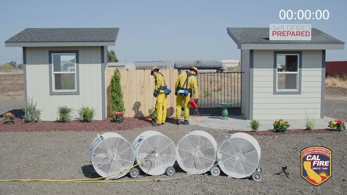
- Ember-resistant vents, enclosed eaves and noncombustible fencing
- Zone 0 hardening within 5 feet of the house
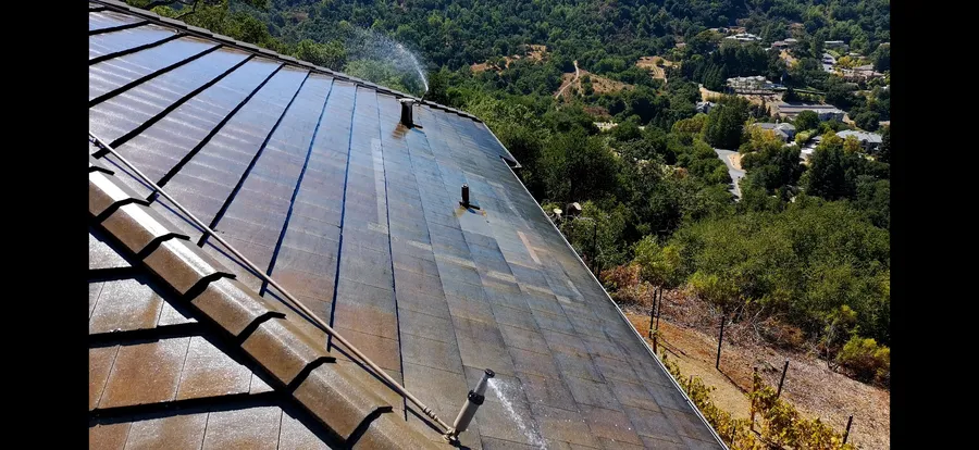
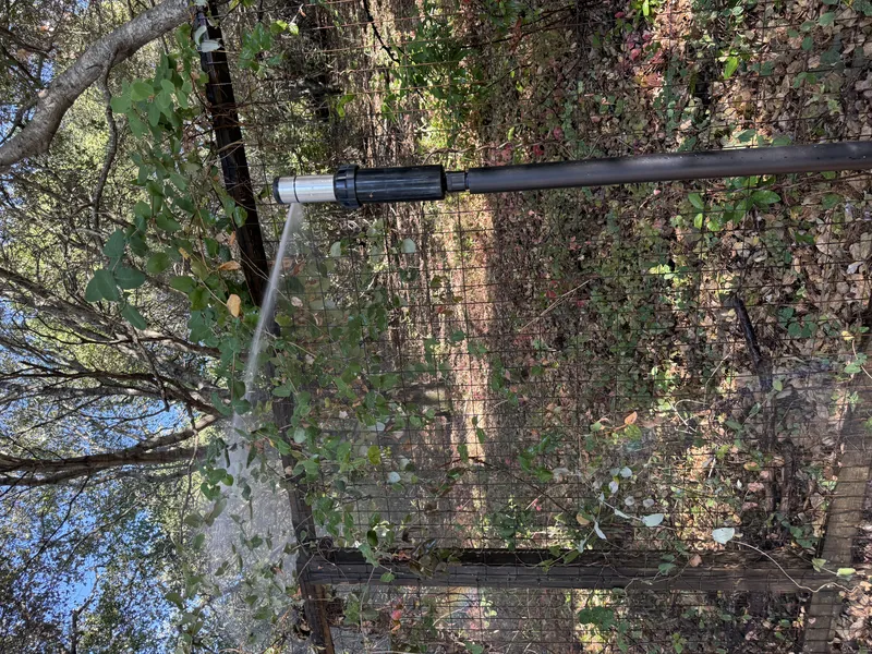
- Automated exterior sprinklers for roof and perimeter
- One insurance documentation packet for every upgrade
Local Wildfire Resources for Castro Valley Homeowners
Rules and requirements can change. Verify current requirements with your city or fire district before taking action.
Tree Removal and Defensible Space Rules
Castro Valley follows Alameda County tree preservation standards. ACFD enforces defensible space requirements. Eucalyptus management is a priority concern given fuel characteristics and ember production on EBRPD parklands.
Fire Hazard Severity Zone: Very High and High FHSZ in hillside and canyon areas. 2025 CAL FIRE maps expanded zones. Local Responsibility Area with some State Responsibility Area edges.
Free Programs for Castro Valley Homeowners
- ACFD defensible space inspections
- Diablo Firesafe Council cost-share matching program for defensible space
- Regional chipper programs
- ACFD community education
Your Fire District
Alameda County Fire Department (ACFD)
Community Designations
- Firewise USA communities in hillside neighborhoods
- Diablo Firesafe Council service area
- Part of Alameda County CWPP
Community designations like Firewise USA and Fire Risk Reduction Community may qualify homeowners for insurance benefits under California's Safer from Wildfires regulation.
Nearby Communities We Serve
FireRoofs also installs wildfire defense systems in neighboring communities with similar WUI risk profiles.
If You Lose the Home
Castro Valley Homeowners and the Real Cost of Total Loss
The eucalyptus-covered hills above Castro Valley are the same fuel type that drove the 1991 Oakland firestorm just a few ridgelines away, and the SCU Lightning Complex in 2020 showed those hills can burn fast. Losing a home in this terrain would put most families into a recovery process that is longer and more expensive than their policy likely anticipates. The numbers from comparable Bay Area disasters are worth knowing before a fire season, not after.
$1.5 billion
Insurance Gaps Found After Oakland
The 1991 Oakland hills firestorm wiped out more than 3,300 single-family homes and produced losses exceeding $1.5 billion. What surprised many survivors was how much their policies fell short of actual rebuild costs.[1]
$300,000
Underinsured by a Wide Margin
The City of Santa Rosa found that roughly two-thirds of households who lost homes in the 2017 Tubbs Fire were underinsured, short by an average of $300,000. Castro Valley hillside homes, many with custom footprints, face similar valuation risks.[2]
10%
Rebuilding Takes Far Longer
Two years after the 2017 Tubbs Fire, only about 10% of destroyed Santa Rosa homes had been rebuilt. Permit backlogs, contractor shortages, and material costs all contributed to a recovery that stretched well beyond what most families planned for.[3]
“When you lose maybe ten homes, you can rebuild them. But, when you lose 6,000 you can’t.”
Keeping Home Insurance in Castro Valley
Because the 2025 maps changed zone lines in unincorporated Castro Valley, start by checking your parcel in the ACFD Hazard Locator and keeping a copy of the result with your policy papers. Underwriters look at location first, and a sale in a High or Very High zone triggers the transfer inspection noted above.
California regulation (10 CCR 2644.9) requires insurers to recognize specific mitigation, including ember-resistant vents, enclosed eaves, a noncombustible 5-foot zone and a Class A roof. Dated photos of each item make the request for a revised wildfire score far easier. FireRoofs documents every upgrade so you can hand one packet to your broker.
Got a notice from your insurer? Here is what to do after a non-renewal.
Request a Private ConsultationProtect Your Castro Valley Property Today
Every Castro Valley property is different. Request a private consultation of your home's wildfire exposure and a custom defense plan.
Common Questions
What wildfire risk does Castro Valley face?
Castro Valley is designated a High fire risk zone by CAL FIRE. Alameda County fire maps confirm elevated exposure driven by oak woodland and eucalyptus groves fuel loads and dry-season wind patterns. Significant eucalyptus groves on EBRPD parklands adjacent to residential areas pose particular concern due to high ember production and extreme fire intensity.
Do exterior wildfire sprinklers qualify for an insurance discount in Castro Valley?
Exterior sprinklers are not one of the named Safer from Wildfires categories, so no carrier is required to discount for them. A documented FireRoofs project produces evidence for the categories that are named, such as ember-resistant vents, enclosed eaves, defensible space and a noncombustible Zone 0. Discounts vary by carrier.
Why is eucalyptus a concern in Castro Valley?
Significant eucalyptus groves on East Bay Regional Park District parklands adjacent to residential areas pose particular concern due to high ember production and extreme fire intensity. EBRPD vegetation management in these areas is an ongoing priority.
What is ACFD's Measure X and how does it affect Castro Valley?
ACFD's Measure X bond is funding fire station replacements including Stations 7, 22, and 25 in Castro Valley and San Lorenzo. This investment improves fire response capability in the community.
Are there free programs for Castro Valley homeowners?
Yes. ACFD conducts defensible space inspections in VHFHSZ areas. The Diablo Firesafe Council offers a cost-share matching program for defensible space work. Regional chipper programs are also available.