Wildfire Risk in Moraga.
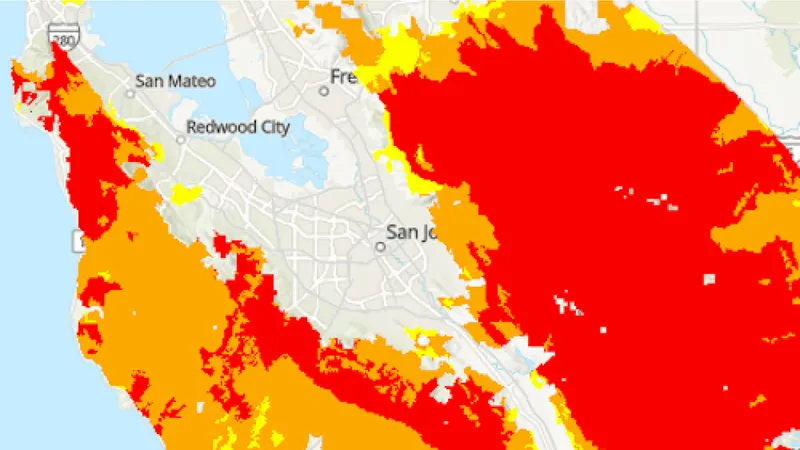
Moraga sits in a bowl of rolling grassland and oak hills southeast of Orinda, with open space on the Lafayette Ridge, Sibley and Redwood regional parks, and the hills above Saint Mary's College. CAL FIRE designates the grassland and oak hillsides ringing the Moraga valley as Very High and High Fire Hazard Severity Zones. The grassy slopes cure to fine, fast-burning fuel every summer, and the community shares the same Diablo wind exposure that drives fire across the entire Lamorinda area.
Moraga at a Glance
Insurance Alert
Moraga homes commonly range from $1.5M to $4M+. Hillside and open-space-adjacent properties face rising non-renewal rates across Contra Costa County.
Historical Fire Record
The terrain and vegetation that define Moraga have fueled fires here for over a century.
Tunnel (East Bay Hills) Firestorm
Burned through the ridgeline wildland shared with Moraga to the northwest, destroying thousands of homes in a single wind-driven afternoon.
SCU Lightning Complex
Burned across the Diablo Range east of Lamorinda, sending heavy smoke over Moraga and prompting regional readiness alerts.
Why Moraga Faces Elevated Risk
Fine Grassland Fuels
Moraga's signature open hillsides cure to flashy grass fuel that ignites easily and spreads fast in wind.
Ridgeline Open Space
Continuous wildland on the Lafayette Ridge and toward Sibley and Redwood parks feeds fire toward hillside neighborhoods.
Diablo Wind Exposure
Fall offshore winds cross the Lamorinda ridgelines, rapidly drying vegetation and driving ember spread.
Sources: CAL FIRE incident data, Marin County fire history archives, First Street Foundation.
Live Bay Area fire status
Track active incidents, Red Flag Warnings, air quality, and PSPS power shutoffs across the greater Bay Area, updated throughout the day.
The Problem
Most Homes Have 3-5 Wildfire Vulnerabilities
Embers cause most home ignitions. They enter through vents, collect under decks, travel along fences, and ignite vegetation at the foundation.
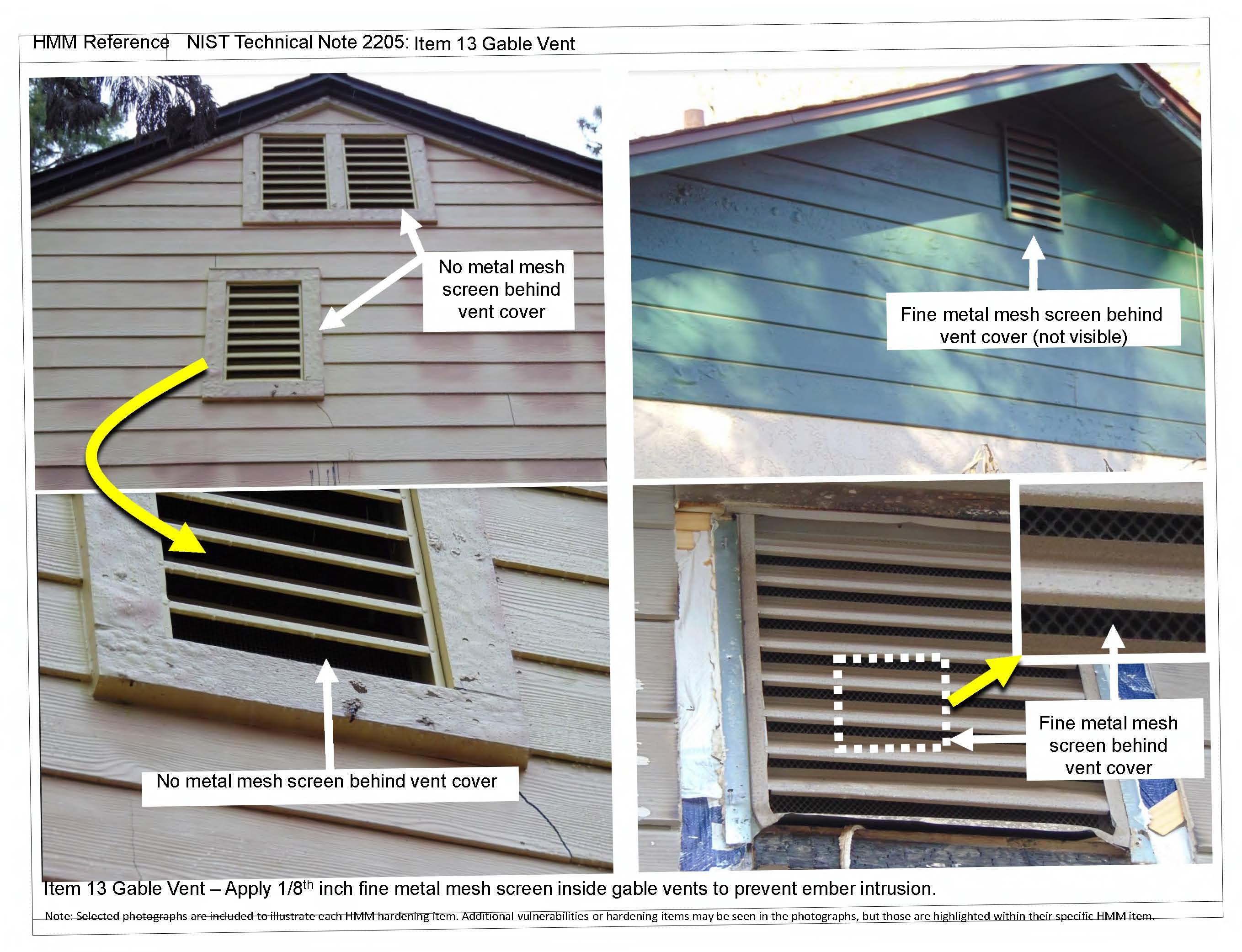
Unscreened vent
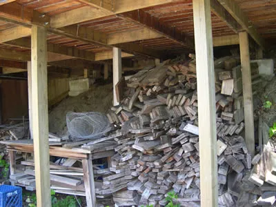
Open deck skirting
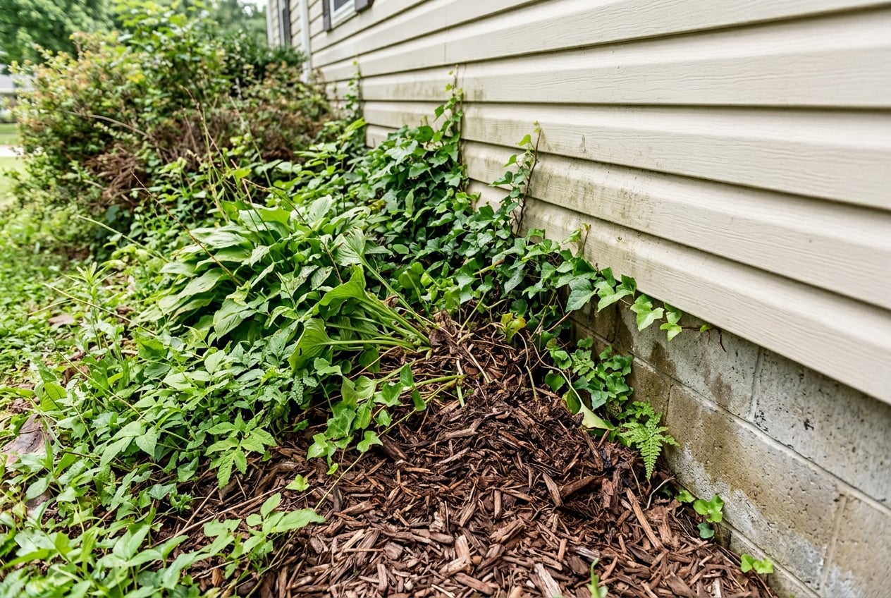
Zone 0 violation
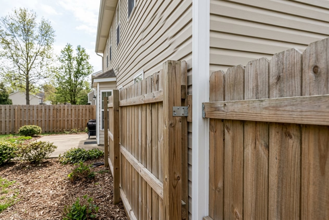
Fence flame path
$149 Assessment Report
California Wildfire Assessment Report
Find out what wildfire risk models and California building codes flag on your property. No site visit. Results same day.
30-minute phone session
We guide you through photos of vents, eaves, decks, fencing, roof, and vegetation. No site visit.
Photo-by-photo analysis
Each finding includes what we see, why it matters, and the specific code section it relates to.
Prioritized action plan
30-day, 90-day, and 12-month timelines. Every item cites CBC Chapter 7A, PRC 4291, or AB 38.
Defensible space scored
Zone 0, Zone 1, and Zone 2 rated for your specific property with clear action items.
Insurance documentation
Documented against the Safer from Wildfires categories the project touches. Hand it to your broker for FAIR Plan or discount qualification.
Contractor-ready fix list
Specific materials, code references, and priority rankings. Any licensed contractor can use it.
Built by a California wildfire defense company from real-world Bay Area experience.
Free Wildfire Map
Not ready for a full assessment? Enter any California address to see fire hazard severity zones, vegetation density, and nearby fire history.
Open Free Wildfire MapDefensible Space & Home Hardening
California law requires property owners in fire hazard zones to maintain defensible space and harden their homes.
Ember-Resistant Zone
0-5 ft
Remove all combustible material within five feet. No mulch, no plants, no firewood. Hardscape only.
Lean, Clean, and Green
5-30 ft
Well-spaced, low plants. Trim branches 6 ft from ground. 10 ft between canopies. Grass to 4 inches.
Fuel Reduction Zone
30-100 ft
Remove ladder fuels. Space shrub groups. Create vertical gaps between ground cover and canopies.
Priority Order
Screen all vents with 1/8-inch metal mesh
Clear Zone 0 (first 5 feet)
Clean gutters and roof of debris
Replace or disconnect wood fence at house
Enclose open eaves and soffits
Enclose or screen deck skirting
Exterior Sprinkler Systems
FireRoofs designs and coordinates automated exterior sprinkler systems in our Bay Area service area (41 communities). They saturate the property before fire arrives, buying critical time.Moraga is not in our installation area, but the assessment report identifies which hardening measures will have the greatest impact on your property.
Common Questions
Is Moraga in a high fire hazard zone?
Yes. CAL FIRE designates the grassland and oak hillsides ringing the Moraga valley as Very High and High Fire Hazard Severity Zones, including areas near Saint Mary's College. The community shares the ridgeline wildland where the 1991 East Bay Hills firestorm burned.
What causes wildfire risk in Moraga?
Moraga's primary risk comes from fine grassland fuel that cures to highly flammable dry grass every summer, combined with Diablo wind exposure that crosses the Lamorinda ridgelines. Continuous open space on the Lafayette Ridge and toward Sibley and Redwood regional parks creates unbroken fuel pathways to residential areas.
Will wildfire risk affect my insurance in Moraga?
Moraga homes commonly range from $1.5M to $4M+, and hillside and open-space-adjacent properties face rising non-renewal rates. California's Safer from Wildfires regulation (Regulation 2644.9) now requires admitted insurers to factor documented home hardening and defensible space improvements into risk assessments. Documenting your property's mitigation measures is the strongest step you can take.
How does a photo-based wildfire assessment work?
A photo-based wildfire assessment is a 30-minute guided phone session where you walk around your property and photograph specific elements: vents, eaves, decks, fencing, roof, vegetation clearance, and attachments. A wildfire defense specialist analyzes each photo against California Building Code Chapter 7A, PRC 4291, and AB 38 requirements. You receive a written report with photo-by-photo findings, code citations, a prioritized action plan, defensible space zone ratings, and insurance documentation you can hand to your broker or any local contractor.
Not in our service area
Your property, your report.
FireRoofs designs and coordinates sprinkler systems in our Bay Area service area. The California Wildfire Assessment Report is available for any property in the state.
This page is not an emergency resource. If you see fire or smoke, call 911. For evacuation alerts in Contra Costa County, register for AlertMarin.