Los Altos Hills Wildfire Defense
Los Altos Hills has the highest median home value in Santa Clara County and some of the most exposed WUI terrain in the Bay Area. The town's 7,000 residents live on large parcels averaging 1-2 acres, surrounded by mature eucalyptus, oak, and bay laurel that create continuous fuel from Rancho San Antonio Open Space through the Page Mill Road corridor to Skyline. There are no commercial buildings, no streetlights, and most roads are single-lane without sidewalks. During a 2021 vegetation fire near Moody Road, the narrow roads caused a traffic jam that delayed evacuation by 45 minutes.
$149 Wildfire Report for Los Altos Hills Homeowners
See what California wildfire codes require for your Los Altos Hills property. Covers roof, vents, defensible space, and insurance paperwork. Get your report in minutes.
properties classified Very High by CAL FIRE
Santa Clara County
Los Altos Hills sits along the Page Mill corridor, where large estate parcels back up against thousands of acres of wildland fuel.
FireRoofs Premier Home Hardening & Active Defense
FireRoofs provides premier wildfire defense and home hardening for Los Altos Hills properties. We combine automated exterior sprinkler systems with structural hardening that addresses every ember entry point on the home.
Automated Exterior Sprinklers
Dual-detection roof and perimeter sprinklers with satellite monitoring
Ember-Resistant Vents
Retrofit vents that seal the attic from ember intrusion
Noncombustible Fencing
Eliminate the fence-to-structure flame path
Zone Zero Hardening
Clear combustible material within 5 feet of the structure
Vegetation Fire Retardant
Applied to surrounding landscape for ember resistance
Insurance Evidence Packet
Mapped to California Regulation 2644.9 for carrier submission
Los Altos Hills occupies some of the highest-elevation residential terrain in Santa Clara County, with properties spread across steep oak woodland and grassland hillsides. The town enforces its own building code requirements for wildfire construction under its Very High Fire Hazard Severity Zone designation. FireRoofs works with Los Altos Hills homeowners to bring existing structures up to current WUI standards.
Stainless Steel Micro Mesh Gutter Guards for Los Altos Hills
Los Altos Hills properties on large lots accumulate significant debris loads from surrounding oak woodland. Dry leaf litter in gutters is one of the first things embers ignite during a wildfire event. Our surgical-grade stainless steel micro mesh gutter guards are noncombustible and corrosion-resistant, meeting the Los Altos Hills building department requirements for exterior wildfire hardening on VHFHSZ properties.
Town of Los Altos Hills - Wildfire Building CodeEmber-Resistant Vent Retrofit in Los Altos Hills
Los Altos Hills homes with legacy vent configurations are vulnerable to embers entering attic and crawl spaces. The town requires WUI-compliant vents on new construction and significant remodels. Vulcan Vents with ASTM E2886 certification and California State Fire Marshal listing provide the highest level of protection, blocking both embers and direct flame while maintaining the net free vent area required for proper attic ventilation.
Vulcan Vents - California WUI ComplianceUnder Deck Enclosure for Los Altos Hills Properties
The steep terrain in Los Altos Hills means many homes have elevated decks with substantial open space underneath. Windblown grass, leaves, and debris accumulate in these sheltered areas and provide ready fuel for embers. Our enclosure system uses noncombustible metal screening with ventilation gaps that prevent moisture buildup while blocking ember access, addressing the deck-specific requirements outlined in the Safer from Wildfires framework.
CA Dept of Insurance - Safer from WildfiresNon Combustible Gate and Fence Installation in Los Altos Hills
Los Altos Hills properties often feature wood entry gates and perimeter fencing that create a direct flame pathway to the home. When a wood fence ignites, fire can bypass all other defensible space measures and reach the structure in minutes. Our noncombustible gate and fence installation uses aluminum, steel, or masonry materials that meet ASTM E136 standards, satisfying the Zone 0 noncombustible fencing requirement within 5 feet of the structure.
Santa Clara County FireSafe - Home HardeningOpen Eave Enclosure for Los Altos Hills Homes
Open eave construction on Los Altos Hills homes creates a direct pathway for embers into the roof structure. The gap between exposed rafter tails allows wind-driven embers to lodge against combustible materials in the attic space. Our retrofit encloses eaves with ignition-resistant soffit materials and WUI-compliant vents listed by the California State Fire Marshal, bringing older construction into alignment with current Chapter 7A standards.
Los Altos Hills - Wildfire Building StandardsWhy Home Hardening Matters in Los Altos Hills
Los Altos Hills estates present a unique challenge: large footprints, multiple structures, extensive vegetation, and limited road access. A fire moving through the open space preserves would reach residential properties before most homeowners could evacuate. FireRoofs designs multi-structure sprinkler systems for estate properties, with copper piping scaled to the lot
We pair active defense with the full hardening scope: noncombustible fencing along property perimeters, ember-resistant vent replacement across all structures, Zone Zero landscape hardening, and defensible space clearance completed by our licensed crew. The evidence packet covers every structure on the lot.

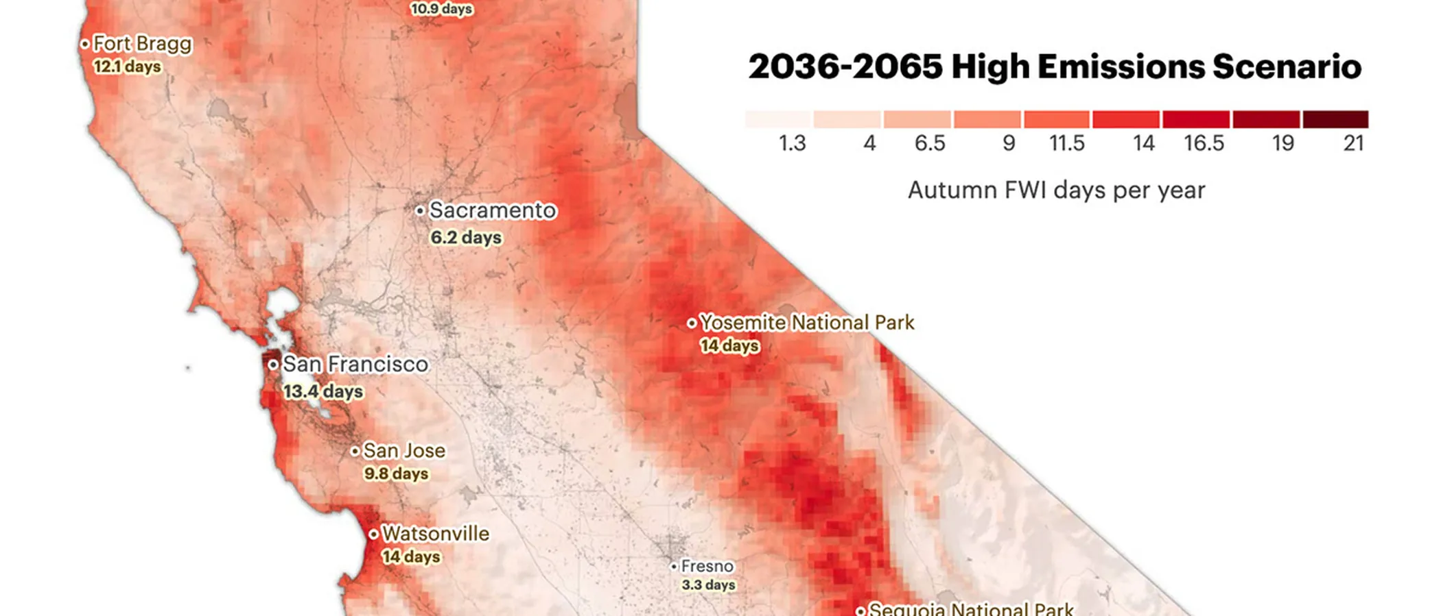
CAL FIRE Very High Fire Hazard Severity Zones (VHFHSZ) shown in red/orange
Source: CAL FIRE Fire Hazard Severity Zone data via Bay Area News Group
CAL FIRE VHFHSZ Designation
Approximately 507 properties are classified as Very High and 178 as High Fire Hazard Severity by CAL FIRE, primarily in areas bordering open space to the west and south.
Los Altos Hills's Wildfire Record
Understanding past fires helps predict future risk. Here are the most significant fire events near Los Altos Hills.
Smoke reached Los Altos Hills; event prompted widespread fire preparedness action among residents.
A fast-moving grass fire near Page Mill Road threatened properties before being contained.
Brush fire in the foothills required multi-agency response to protect nearby homes.
Local Risk Factors
Rancho San Antonio Interface
Thousands of acres of open space preserve directly border residential properties with continuous vegetation fuel.
Large Canopy Coverage
Mature oak and eucalyptus provide shade but also create fuel ladders and increase ember production during fires.
Hillside Road Network
Winding hillside roads with limited sight lines create dangerous conditions during evacuation.
Water Pressure Issues
Higher-elevation properties may experience reduced water pressure during peak demand firefighting operations.
Book a free on-site evaluation. We will design and install the right sprinkler and hardening system for your home.
Book Free EvaluationGet the $149 assessment report. Find out what wildfire risk models flag on your property. Results in minutes.
Get $149 ReportLos Altos Hills Fire Environment
Vegetation Types
Wind Patterns
Moderate offshore wind exposure; thermal updrafts from valley floor
Topography
Elevation 400-1,800 ft. Gently rolling to steep western slopes.
Fire District
Santa Clara County Fire, Foothill Station
Insurance Impact
Los Altos Hills residents have reported insurance non-renewals increasing sharply since 2019, with significant premium increases for those retaining coverage.
Protecting Your Los Altos Hills Home & Family
Living in a fire-prone area means being proactive. Here are the steps every Los Altos Hills homeowner should take to protect their property and prepare for wildfire season.
Evacuation Planning
Los Altos Hills has winding, narrow private roads that complicate evacuation. Register for AlertSCC and know your designated routes. Many residents rely on a single road for access. consider multiple exit strategies.
Defensible Space
Large lot sizes in Los Altos Hills mean more vegetation to manage. Maintain 100 feet of defensible space, especially on slopes. The Santa Clara County Fire Department offers free WUI preparedness inspections. call (408) 378-4010 to schedule one.


Your Local Fire Safe Council
Santa Clara County FireSafe Council
The Santa Clara County FireSafe Council offers free resources, community chipping programs, home assessments, and education to help Los Altos Hills residents reduce wildfire risk and prepare for fire season.
Visit Santa Clara County FireSafe CouncilLos Altos Hills Wildfire Preparedness Resources
Santa Clara County FireSafe Council
Defensible space programs, chipping services, and Home Ignition Zone assessments for Los Altos Hills.
SCC FireSafe CouncilSCC Fire Department WUI Inspections
Free wildfire preparedness inspections for hillside properties in Los Altos Hills.
SCC Fire DepartmentReady for Wildfire Evacuation Checklist
CAL FIRE official checklist for wildfire evacuation planning and go-bag preparation.
CAL FIREProtect Your Los Altos Hills Home with FireRoofs
Defensible space and evacuation planning are essential, but they have limits. When embers are raining down and flames are approaching, your home needs both an automated active defense system and structural hardening that eliminates every ember entry point.
FireRoofs combines automated exterior sprinkler systems with structural home hardening for Los Altos Hills properties. Our Detect → Alert → Defend system uses intelligent wildfire detection cameras, satellite monitoring, and high-pressure water to saturate your property. Our hardening scope seals every vulnerability embers exploit.
- Automated exterior sprinklers: roof and perimeter coverage with dual detection
- Ember-resistant vent retrofits to seal the attic from intrusion
- Noncombustible fencing to eliminate the fence-to-structure flame path
- Zone Zero landscape hardening within 5 feet of the structure
- Vegetation fire retardant application for surrounding landscape
- Class A firefighting foam add-on: 100% biodegradable, non-toxic, rinses off through sprinklers
- Insurance evidence packet documenting all upgrades, mapped to California Regulation 2644.9


Local Wildfire Resources for Los Altos Hills Homeowners
Rules and requirements can change. Verify current requirements with your city or fire district before taking action.

Tree Removal and Defensible Space Rules
Permits required for trees over 9 inches diameter (at 24 inches height). Exemptions for dead/dying trees and defensible space removals within 30 feet per PRC 4291. Heritage tree protections with VHFHSZ exceptions for ladder fuels and high-risk species like eucalyptus. Local fire code requires 30-foot firebreaks. Stricter local requirements for decks and porches within 10 feet.
Fire Hazard Severity Zone: Very High (approximately 70-90% of town). Local Responsibility Area. 2025 CAL FIRE maps expanded zones.

Free Programs for Los Altos Hills Homeowners
- Home Ignition Zone (HIZ) Assessment and Rebate Program
- Retired tree program
- Santa Clara County Fire Safe Council chipper days
Community Designations
- Multiple Firewise USA neighborhoods
Community designations like Firewise USA and Fire Risk Reduction Community may qualify homeowners for insurance benefits under California's Safer from Wildfires regulation.

Statewide Zone 0 Compliance Timeline
Board of Forestry rulemaking targeted for completion by December 31, 2025. New construction: compliance begins once rules are adopted (projected 2026). Existing structures: 3-year phase-in (compliance expected by approximately 2028-2029).
State Defensible Space (PRC 4291)
Zone 0: 0-5 feet, ember-resistant/noncombustible. Zone 1: 5-30 feet, lean, clean, and green. Zone 2: 30-100 feet, reduced fuel loading. Annual compliance inspections by local fire districts during fire season.
California Building Code
Effective 2026, California Wildland-Urban Interface Code (CWUIC) Part 7 replaces CBC Chapter 7A. Applies to new construction in designated fire hazard zones.
How FireRoofs Fits In
Understanding your local requirements is the first step. A FireRoofs automated defense system works alongside your defensible space, home hardening, and community efforts to give your home the strongest possible protection. During your free property evaluation, our team reviews your property in the context of Los Altos Hills's specific requirements and helps you understand how active defense fits into your overall wildfire strategy.
Nearby Communities We Serve
FireRoofs also installs wildfire defense systems in neighboring communities with similar WUI risk profiles.
2026 Insurance Alert for Los Altos Hills Homeowners
Los Altos Hills properties are among the highest-value homes in the Bay Area, which means the FAIR Plan’s $3M cap leaves a catastrophic coverage gap. Premier hardening and active defense documented in a carrier-ready evidence packet gives you the strongest possible case for surplus lines coverage.
California's SB 429 (effective January 1, 2026) establishes the nation's first public wildfire catastrophe model, giving homeowners new tools to understand insurance risk scores. Ask HydroIQ what this means for Los Altos Hills homeowners.
Request a Free Property EvaluationAsk HydroIQ About Los Altos Hills - Free AI Wildfire Assistant
Get instant answers about Los Altos Hills's wildfire risk level, defensible space requirements, fire history, FAIR Plan insurance options, and how exterior sprinkler systems can protect your home. HydroIQ covers communities across all nine Bay Area counties.
Protect Your Los Altos Hills Property Today
Every Los Altos Hills property is different. Get a free evaluation of your home's wildfire exposure and a custom defense plan.
Common Questions
What wildfire risk does Los Altos Hills face?
Los Altos Hills is designated a Very High Fire Hazard Severity Zone by CAL FIRE. Santa Clara County fire maps confirm extreme exposure driven by coast live oak and eucalyptus fuel loads and seasonal offshore winds. Thousands of acres of open space preserve directly border residential properties with continuous vegetation fuel.
How does FireRoofs protect Los Altos Hills homes from wildfire?
FireRoofs provides both active defense and passive home hardening for Los Altos Hills properties. Active defense includes automated exterior sprinkler systems with dual detection, satellite monitoring, and intelligent fire detection cameras. Passive hardening covers ember-resistant vent retrofits, noncombustible fencing, Zone Zero landscape hardening, exterior cladding upgrades, and vegetation fire retardant. Every upgrade is documented in one evidence packet mapped to California Regulation 2644.9 for insurance recognition.
What does home hardening include for a Los Altos Hills property?
Home hardening for Los Altos Hills properties addresses every ember entry point on the structure. FireRoofs performs ember-resistant vent installation, noncombustible fencing replacement, eave and soffit sealing, Zone Zero landscape clearance within 5 feet of the structure, vegetation fire retardant application, and exterior cladding upgrades where needed. Scope is determined during a free property evaluation and accounts for local terrain and elevation changes. All work is documented for insurance submission.
Where can I get instant answers about Los Altos Hills's wildfire risk?
HydroIQ is FireRoofs' free wildfire assistant that provides instant, city-specific answers about Los Altos Hills's fire hazard zone classification, defensible space requirements, local fire history, FAIR Plan insurance options, and wildfire defense systems. No sign-up required. Visit fireroofs.com/hydroiq to learn more or ask a question directly.
What is California home hardening?
California home hardening is the process of retrofitting a structure to resist wildfire ember intrusion and radiant heat exposure. It includes replacing combustible building materials, sealing openings such as attic vents and eaves, installing noncombustible fencing, clearing the Zone Zero perimeter within 5 feet of the structure, and applying fire-resistant treatments. Home hardening is one of the 12 mitigation categories under California Regulation 2644.9 (Safer from Wildfires) that participating insurers must recognize when setting premiums.
How do I get off the California FAIR Plan?
To transition from the California FAIR Plan back to the voluntary insurance market, homeowners need to demonstrate documented wildfire risk reduction. This includes property-level mitigation such as home hardening, automated exterior sprinkler systems, and defensible space maintenance. Under California Regulation 2644.9, admitted insurers are required to offer premium discounts for documented mitigation across 12 categories. FireRoofs provides the upgrades and the evidence packet that documents each improvement for your insurer or broker.
What are the 12 Safer from Wildfires mitigation categories?
California Regulation 2644.9 defines 12 mitigation categories that insurers must recognize: (1) Class A fire-rated roof, (2) Enclosed eaves, (3) Ember-resistant vents, (4) Exterior wall cladding, (5) Dual-pane or tempered windows, (6) Noncombustible fencing within 5 feet, (7) Defensible space Zone 0-2 maintained, (8) Community-level mitigation (Fire Risk Reduction Community), (9) Active fire defense system such as exterior sprinklers, (10) Fire-resistant landscaping, (11) Access and water supply, (12) Structure-specific risk reduction. FireRoofs addresses categories 1 through 10 directly.
Do exterior roof sprinklers qualify for insurance discounts in California?
Yes. Automated exterior sprinkler systems are recognized under Category 9 (Active Fire Defense System) of California Regulation 2644.9. When documented in an evidence packet and submitted to your insurer, they count toward the mitigation credits that admitted carriers are required to apply. FireRoofs installs dual-detection exterior sprinkler systems and provides the documentation package for insurance recognition. SB 429 (effective January 1, 2026) further supports this by establishing a public wildfire catastrophe model that factors documented improvements into risk scoring.
What tree removal permits are needed in Los Altos Hills?
Permits are required for trees over 9 inches diameter (measured at 24 inches height). Exemptions exist for dead or dying trees and defensible space removals within 30 feet of structures per PRC 4291. Heritage tree protections include VHFHSZ exceptions for ladder fuels and high-risk species like eucalyptus.
Does Los Altos Hills offer rebates for wildfire defense?
Yes. Los Altos Hills offers a Home Ignition Zone Assessment and Rebate Program, a retired tree program, and access to Santa Clara County Fire Safe Council chipper days. Contact the fire district for current program details.
Is Los Altos Hills a Firewise USA community?
Yes. Multiple Los Altos Hills neighborhoods hold Firewise USA recognition, which may help with insurance eligibility under California's Safer from Wildfires regulation.