Stanford/Skyline Wildfire Defense
The Skyline Boulevard corridor runs along the spine of the Santa Cruz Mountains at elevations between 1,800 and 2,600 feet, separating Santa Clara and San Mateo counties. Homes along Skyline, Page Mill Road, and Alpine Road are some of the most isolated residential properties in the Bay Area. Cell coverage is spotty, water comes from wells or small community systems, and the nearest fire station can be 20 minutes away on winding mountain roads. The Stanford foothills below connect this ridgeline to the valley through thousands of acres of Jasper Ridge Biological Preserve and Monte Bello Open Space Preserve, all of it unmanaged wildland fuel.
$149 Wildfire Report for Stanford/Skyline Homeowners
See what California wildfire codes require for your Stanford/Skyline property. Covers roof, vents, defensible space, and insurance paperwork. Get your report in minutes.
acres of wildland bordering Stanford foothills and Skyline Boulevard
Santa Clara / San Mateo County
The Skyline corridor sits at 1,800-2,600 feet elevation with limited cell coverage, well water, and fire response times up to 20 minutes.
FireRoofs Premier Home Hardening & Active Defense
FireRoofs provides premier wildfire defense and home hardening for Stanford/Skyline properties. We combine automated exterior sprinkler systems with structural hardening that addresses every ember entry point on the home.
Automated Exterior Sprinklers
Dual-detection roof and perimeter sprinklers with satellite monitoring
Ember-Resistant Vents
Retrofit vents that seal the attic from ember intrusion
Noncombustible Fencing
Eliminate the fence-to-structure flame path
Zone Zero Hardening
Clear combustible material within 5 feet of the structure
Vegetation Fire Retardant
Applied to surrounding landscape for ember resistance
Insurance Evidence Packet
Mapped to California Regulation 2644.9 for carrier submission
The Stanford-Skyline area encompasses properties along Skyline Boulevard and adjacent ridgelines in unincorporated San Mateo County. Homes here border extensive open space preserves and face some of the highest wildfire exposure in the Peninsula region. Dense mixed hardwood forest, steep terrain, and limited access roads make comprehensive hardening essential for every structure.
Micro Mesh Gutter Guard Installation on Stanford-Skyline
Skyline Boulevard properties sit within dense Douglas fir and tanoak forest that produces heavy needle and leaf debris. These remote ridgeline homes are among the first structures embers reach during a fire pushing uphill from valley floors. Our noncombustible stainless steel micro mesh gutter guards eliminate the gutter fuel bed, denying embers one of their most common ignition targets on Skyline-area homes.
Fire Safe San Mateo - Home HardeningEmber & Flame Resistant Vent Retrofit on Stanford-Skyline
Wind exposure along the Skyline ridge drives embers at high velocity into vent openings on exposed homes. Standard mesh vents offer no meaningful protection at these wind speeds. Vulcan Vents combine fine stainless steel ember mesh with intumescent honeycomb technology that seals under heat, blocking both wind-driven embers and direct flame impingement. ASTM E2886 certification confirms performance under the extreme conditions Skyline properties face.
Vulcan Vents - WUI Compliance GuideNoncombustible Fuelbreak for Stanford-Skyline Properties
Stanford-Skyline homes are surrounded by wildland vegetation that often grows directly to the structure. The Zone 0 ember-resistant zone under AB 3074 requires the first 5 feet to be free of combustible materials. Our fuelbreak installation removes organic mulch, deadwood, and combustible plantings from the immediate building perimeter, replacing them with gravel or hardscape that stops embers from igniting at the foundation.
Board of Forestry - Zone 0 RegulationsUnder Deck Enclosure for Stanford-Skyline Homes
Steep ridgeline lots along Skyline Boulevard often require elevated deck structures with significant open space beneath. Debris accumulates in these sheltered areas faster than on flat lots due to wind patterns at elevation. Our noncombustible under deck enclosure prevents embers from reaching accumulated fuel under the deck while allowing the air circulation these elevated structures need to prevent moisture damage.
Fire Safe Marin - Deck Protection GuideNon Combustible Gate and Fence Installation on Skyline
Entry gates and property fencing along Skyline Boulevard are frequently constructed from wood, creating direct fire pathways from roadside vegetation to the home. Our noncombustible gate and fence installation replaces vulnerable wood sections with steel or aluminum systems that withstand flame contact without igniting. This addresses the Zone 0 requirement for noncombustible materials within 5 feet of the structure.
CA Dept of Insurance - Wildfire MitigationWhy Home Hardening Matters in Stanford/Skyline
Skyline properties face the most extreme fire conditions in the Bay Area. The combination of ridge winds, steep terrain, continuous fuel, and limited road access means these homes must be able to survive without firefighter intervention. FireRoofs designs Fortress-tier systems for Skyline properties, with Class A foam, tank or pool failover, and satellite communication for when local networks fail
The hardening scope is comprehensive: every vent, every eave, every fence line, every foot of Zone Zero. The evidence packet for a Skyline property reflects the highest level of mitigation available.

CAL FIRE Very High Fire Hazard Severity Zones (VHFHSZ) shown in red/orange
Source: CAL FIRE Fire Hazard Severity Zone data via Bay Area News Group
CAL FIRE VHFHSZ Designation
The Stanford foothills and Skyline Boulevard corridor are designated as Very High Fire Hazard Severity Zones by CAL FIRE. The designation covers areas along both sides of the ridge.
Stanford/Skyline's Wildfire Record
Understanding past fires helps predict future risk. Here are the most significant fire events near Stanford/Skyline.
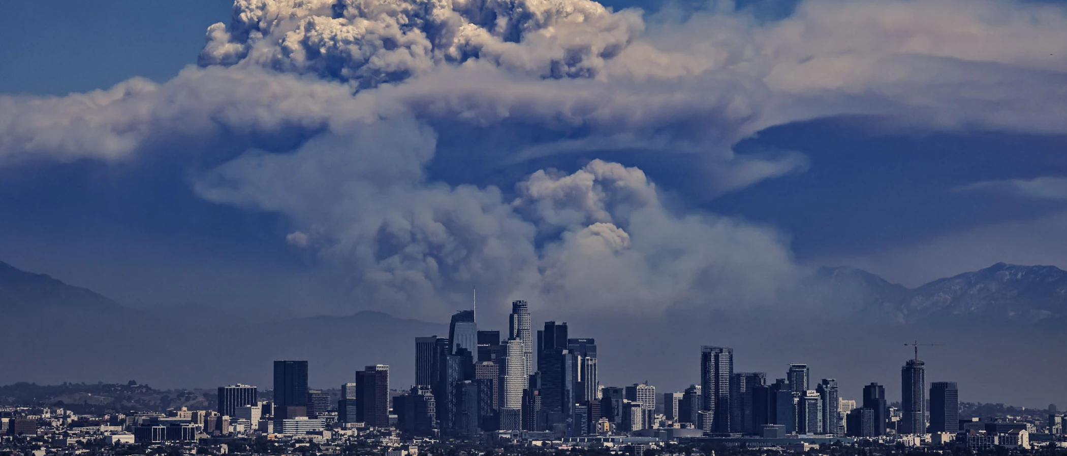
Burned 86,509 acres in the Santa Cruz Mountains. Skyline Boulevard communities were under evacuation orders.
Over 13,000 acres burned in the hills above Lexington Reservoir, threatening Skyline corridor homes.
Local Risk Factors
Ridgeline Wind Exposure
Skyline Boulevard runs along the crest of the Santa Cruz Mountains where winds are strongest and most unpredictable, creating extreme fire weather conditions.
Vast Wildland Interface
Homes along this corridor are surrounded on multiple sides by thousands of acres of grassland, chaparral, and oak woodland.
Remote Access
Many properties are accessed by long driveways off narrow mountain roads, complicating both evacuation and fire suppression access.
Variable Terrain
Steep canyons on both sides of the ridge create fire chimneys that accelerate fire spread.
Book a free on-site evaluation. We will design and install the right sprinkler and hardening system for your home.
Book Free EvaluationGet the $149 assessment report. Find out what wildfire risk models flag on your property. Results in minutes.
Get $149 ReportStanford/Skyline Fire Environment
Vegetation Types
Wind Patterns
Extremely strong offshore (Diablo-type) winds along the ridge; fog and marine layer on the western side
Topography
Elevation ranges from 800 ft to 2,500 ft along the ridge. Steep terrain on both east and west slopes.
Fire District
Woodside Fire Protection District / CAL FIRE
Insurance Impact
Skyline corridor properties face severe insurance challenges. Many carriers will not write policies for ridgeline homes. FAIR Plan enrollment is common in this area.
Protecting Your Stanford/Skyline Home & Family
Living in a fire-prone area means being proactive. Here are the steps every Stanford/Skyline homeowner should take to protect their property and prepare for wildfire season.
Evacuation Planning
Skyline Boulevard can be closed rapidly during fire events. Know evacuation routes in both directions (north toward Hwy 92 and south toward Hwy 9). Register for both SMC Alert and AlertSCC depending on which county your property falls in.
Defensible Space
Ridge-top properties need 200+ feet of defensible space where possible. Remove all dead vegetation within the first 30 feet and maintain low-growing, fire-resistant plants. Chipper programs are available through FIRE SAFE San Mateo County.


Your Local Fire Safe Council
Skyline/Woodside Fire Safe Council
The Skyline/Woodside Fire Safe Council offers free resources, community chipping programs, home assessments, and education to help Stanford/Skyline residents reduce wildfire risk and prepare for fire season.
Visit Skyline/Woodside Fire Safe CouncilStanford/Skyline Wildfire Preparedness Resources
FIRE SAFE San Mateo County
Free chipper program, home hardening guides, and community fire safety education.
Fire Safe San MateoSanta Clara County FireSafe Council
Free chipping, HIZ inspections, defensible space assistance for properties on the Santa Clara side.
SCC FireSafe CouncilCAL FIRE Defensible Space Guide
Official California guide to creating defensible space zones around your property.
CAL FIREProtect Your Stanford/Skyline Home with FireRoofs
Defensible space and evacuation planning are essential, but they have limits. When embers are raining down and flames are approaching, your home needs both an automated active defense system and structural hardening that eliminates every ember entry point.
FireRoofs combines automated exterior sprinkler systems with structural home hardening for Stanford/Skyline properties. Our Detect → Alert → Defend system uses intelligent wildfire detection cameras, satellite monitoring, and high-pressure water to saturate your property. Our hardening scope seals every vulnerability embers exploit.
- Automated exterior sprinklers: roof and perimeter coverage with dual detection
- Ember-resistant vent retrofits to seal the attic from intrusion
- Noncombustible fencing to eliminate the fence-to-structure flame path
- Zone Zero landscape hardening within 5 feet of the structure
- Vegetation fire retardant application for surrounding landscape
- Class A firefighting foam add-on: 100% biodegradable, non-toxic, rinses off through sprinklers
- Insurance evidence packet documenting all upgrades, mapped to California Regulation 2644.9


Local Wildfire Resources for Stanford/Skyline Homeowners
Rules and requirements can change. Verify current requirements with your city or fire district before taking action.

Tree Removal and Defensible Space Rules
San Mateo County permits for native trees over 10 inches diameter. WFPD Ordinance 24-01 applies for properties in WFPD jurisdiction. Stanford manages vegetation on university lands per its fire management plan.
Fire Hazard Severity Zone: Very High. Mix of Local and State Responsibility Areas.

Free Programs for Stanford/Skyline Homeowners
- WFPD chipper program
Your Fire District
Woodside Fire Protection District (WFPD) / Palo Alto Fire Department

Statewide Zone 0 Compliance Timeline
Board of Forestry rulemaking targeted for completion by December 31, 2025. New construction: compliance begins once rules are adopted (projected 2026). Existing structures: 3-year phase-in (compliance expected by approximately 2028-2029).
State Defensible Space (PRC 4291)
Zone 0: 0-5 feet, ember-resistant/noncombustible. Zone 1: 5-30 feet, lean, clean, and green. Zone 2: 30-100 feet, reduced fuel loading. Annual compliance inspections by local fire districts during fire season.
California Building Code
Effective 2026, California Wildland-Urban Interface Code (CWUIC) Part 7 replaces CBC Chapter 7A. Applies to new construction in designated fire hazard zones.
How FireRoofs Fits In
Understanding your local requirements is the first step. A FireRoofs automated defense system works alongside your defensible space, home hardening, and community efforts to give your home the strongest possible protection. During your free property evaluation, our team reviews your property in the context of Stanford/Skyline's specific requirements and helps you understand how active defense fits into your overall wildfire strategy.
Nearby Communities We Serve
FireRoofs also installs wildfire defense systems in neighboring communities with similar WUI risk profiles.
2026 Insurance Alert for Stanford/Skyline Homeowners
Homeowners in Stanford/Skyline are facing surging FAIR Plan rates and non-renewals from private carriers. California's Safer from Wildfires framework now requires participating insurers to offer discounts for documented mitigation systems. FireRoofs provides the engineering documentation and evidence packet designed to help you qualify for the voluntary market.
California's SB 429 (effective January 1, 2026) establishes the nation's first public wildfire catastrophe model, giving homeowners new tools to understand insurance risk scores. Ask HydroIQ what this means for Stanford/Skyline homeowners.
Request a Free Property EvaluationAsk HydroIQ About Stanford/Skyline - Free AI Wildfire Assistant
Get instant answers about Stanford/Skyline's wildfire risk level, defensible space requirements, fire history, FAIR Plan insurance options, and how exterior sprinkler systems can protect your home. HydroIQ covers communities across all nine Bay Area counties.
Protect Your Stanford/Skyline Property Today
Every Stanford/Skyline property is different. Get a free evaluation of your home's wildfire exposure and a custom defense plan.
Common Questions
What wildfire risk does Stanford/Skyline face?
Stanford/Skyline is designated a Very High Fire Hazard Severity Zone by CAL FIRE. Santa Clara / San Mateo County fire maps confirm extreme exposure driven by coast live oak woodland and chaparral fuel loads and seasonal offshore winds. Skyline Boulevard runs along the crest of the Santa Cruz Mountains where winds are strongest and most unpredictable, creating extreme fire weather conditions.
How does FireRoofs protect Stanford/Skyline homes from wildfire?
FireRoofs provides both active defense and passive home hardening for Stanford/Skyline properties. Active defense includes automated exterior sprinkler systems with dual detection, satellite monitoring, and intelligent fire detection cameras. Passive hardening covers ember-resistant vent retrofits, noncombustible fencing, Zone Zero landscape hardening, exterior cladding upgrades, and vegetation fire retardant. Every upgrade is documented in one evidence packet mapped to California Regulation 2644.9 for insurance recognition.
What does home hardening include for a Stanford/Skyline property?
Home hardening for Stanford/Skyline properties addresses every ember entry point on the structure. FireRoofs performs ember-resistant vent installation, noncombustible fencing replacement, eave and soffit sealing, Zone Zero landscape clearance within 5 feet of the structure, vegetation fire retardant application, and exterior cladding upgrades where needed. Scope is determined during a free property evaluation and accounts for local terrain and elevation changes. All work is documented for insurance submission.
Where can I get instant answers about Stanford/Skyline's wildfire risk?
HydroIQ is FireRoofs' free wildfire assistant that provides instant, city-specific answers about Stanford/Skyline's fire hazard zone classification, defensible space requirements, local fire history, FAIR Plan insurance options, and wildfire defense systems. No sign-up required. Visit fireroofs.com/hydroiq to learn more or ask a question directly.
What is California home hardening?
California home hardening is the process of retrofitting a structure to resist wildfire ember intrusion and radiant heat exposure. It includes replacing combustible building materials, sealing openings such as attic vents and eaves, installing noncombustible fencing, clearing the Zone Zero perimeter within 5 feet of the structure, and applying fire-resistant treatments. Home hardening is one of the 12 mitigation categories under California Regulation 2644.9 (Safer from Wildfires) that participating insurers must recognize when setting premiums.
How do I get off the California FAIR Plan?
To transition from the California FAIR Plan back to the voluntary insurance market, homeowners need to demonstrate documented wildfire risk reduction. This includes property-level mitigation such as home hardening, automated exterior sprinkler systems, and defensible space maintenance. Under California Regulation 2644.9, admitted insurers are required to offer premium discounts for documented mitigation across 12 categories. FireRoofs provides the upgrades and the evidence packet that documents each improvement for your insurer or broker.
What are the 12 Safer from Wildfires mitigation categories?
California Regulation 2644.9 defines 12 mitigation categories that insurers must recognize: (1) Class A fire-rated roof, (2) Enclosed eaves, (3) Ember-resistant vents, (4) Exterior wall cladding, (5) Dual-pane or tempered windows, (6) Noncombustible fencing within 5 feet, (7) Defensible space Zone 0-2 maintained, (8) Community-level mitigation (Fire Risk Reduction Community), (9) Active fire defense system such as exterior sprinklers, (10) Fire-resistant landscaping, (11) Access and water supply, (12) Structure-specific risk reduction. FireRoofs addresses categories 1 through 10 directly.
Do exterior roof sprinklers qualify for insurance discounts in California?
Yes. Automated exterior sprinkler systems are recognized under Category 9 (Active Fire Defense System) of California Regulation 2644.9. When documented in an evidence packet and submitted to your insurer, they count toward the mitigation credits that admitted carriers are required to apply. FireRoofs installs dual-detection exterior sprinkler systems and provides the documentation package for insurance recognition. SB 429 (effective January 1, 2026) further supports this by establishing a public wildfire catastrophe model that factors documented improvements into risk scoring.
What fire districts serve the Stanford/Skyline area?
The Stanford/Skyline corridor is served by the Woodside Fire Protection District and Palo Alto Fire Department, depending on location. WFPD Ordinance 24-01 requires fuel mitigation for properties in their jurisdiction.