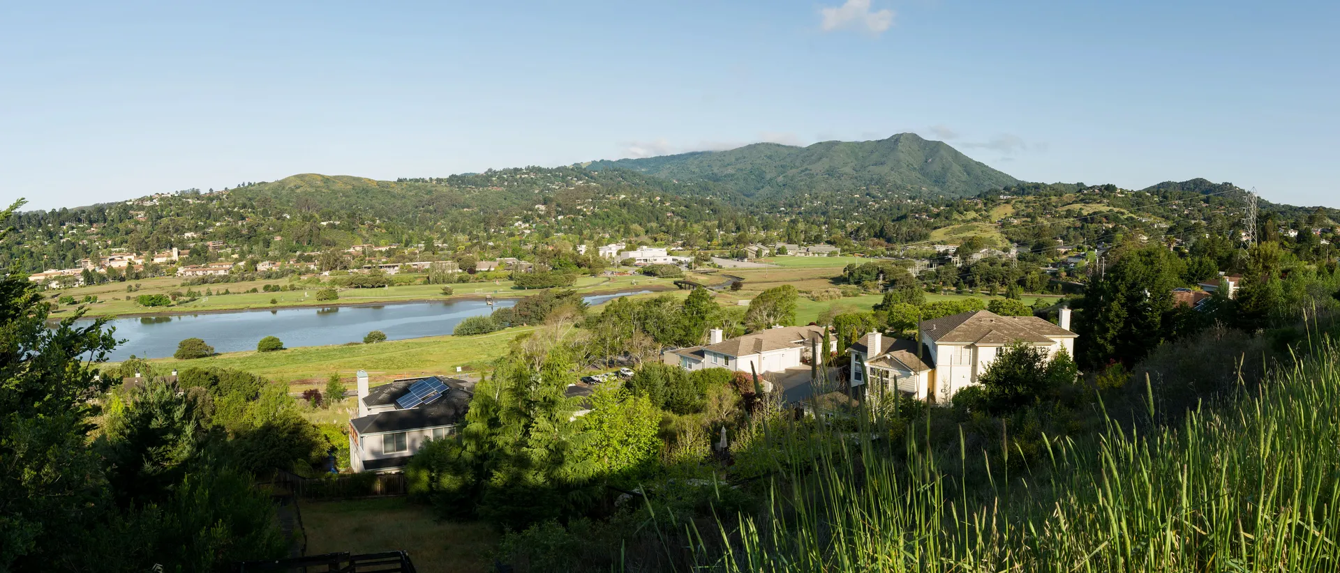
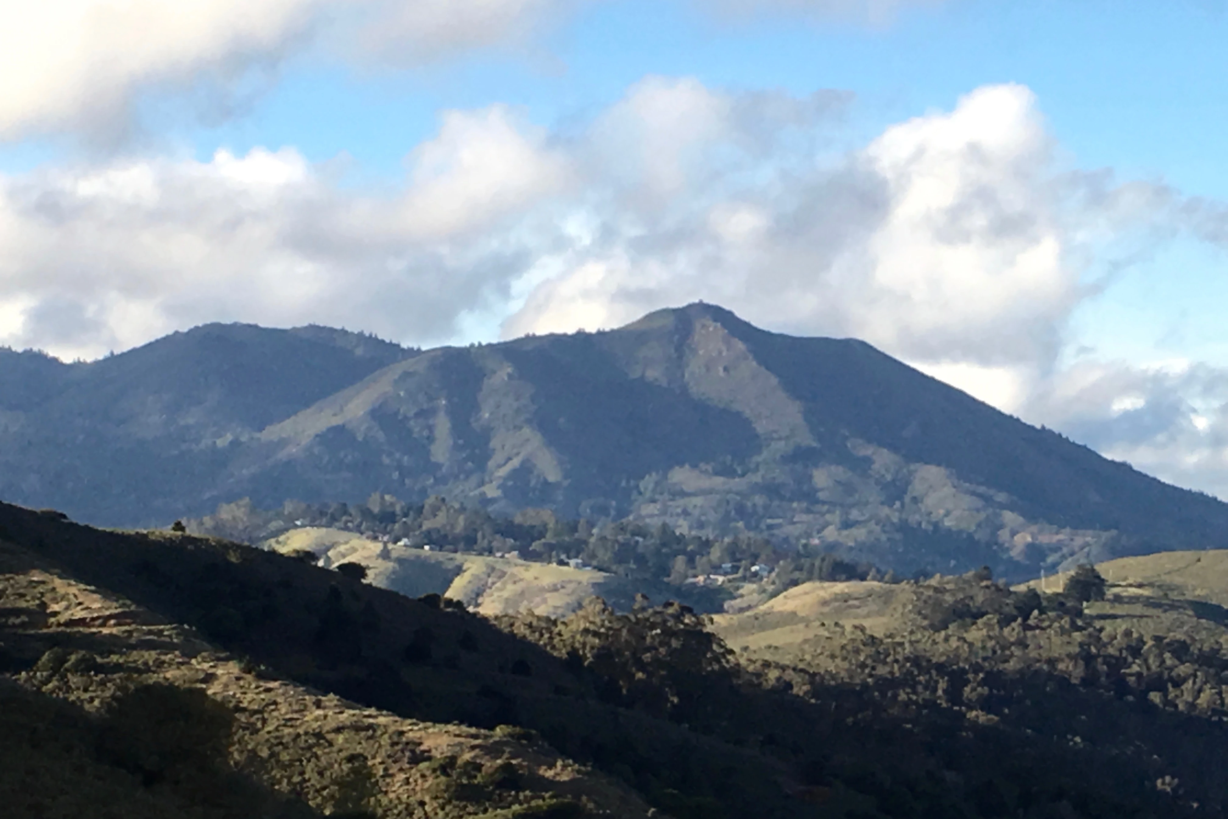
Wildfire Risk in Mill Valley.
Mill Valley sits in a box canyon on Mount Tamalpais, and nearly every property in town carries wildfire risk. CAL FIRE classifies it as a Very High Fire Hazard Severity Zone. The 1929 fire destroyed 117 homes in three days, and the conditions that caused it have not changed. Steep terrain, dense vegetation, narrow roads out. In 2025, the state expanded the hazard boundaries even further into Mill Valley.
Photo by Frank Schulenburg, CC BY-SA 3.0, via Wikimedia Commons
Mill Valley at a Glance
Insurance Alert
Multiple insurers have non-renewed policies across Marin County since 2020. FAIR Plan enrollment has increased significantly. Homeowners report difficulty finding voluntary market coverage for VHFHSZ properties.
Historical Fire Record
The terrain and vegetation that define Mill Valley have fueled fires here for over a century.
Mill Valley Fire
Started near railroad tracks on July 2. Driven by 30 mph winds, it burned for three days and destroyed 117 homes, causing over $1 million in damages.
Carson Canyon Fire
Burned 18,000 acres over seven days on Mount Tamalpais, destroying a sawmill and threatening Mill Valley neighborhoods.
Corte Madera-Mill Valley Fire
A major fire threatened Mill Valley, Larkspur, and Corte Madera. Only a sudden rainstorm prevented widespread destruction.
Mount Tamalpais Fire
A land-clearing fire burned for seven days and consumed approximately 65,000 acres across the mountain.
Why Mill Valley Faces Elevated Risk
Box Canyon Topography
Mill Valley sits in a steep box canyon on the flanks of Mount Tamalpais. Narrow gorges act as natural fire chimneys, concentrating heat and accelerating flames upslope toward residential areas.
Dense Vegetation Fuel Load
Redwood forests, chaparral, and non-native eucalyptus create heavy fuel loads. Dense canopy cover and accumulated duff on the forest floor provide continuous fuel from ground to treetop.
Offshore Wind Exposure
Hot, dry offshore winds arrive in early fall following dry summers. Under these conditions, fire officials warn that 30 mph winds can push fire through Mill Valley with devastating speed.
Limited Evacuation Capacity
Narrow, winding roads throughout Mill Valley create bottlenecks during evacuation. The city has over 175 pedestrian paths but limited vehicle egress routes from hillside neighborhoods.
Sources: CAL FIRE incident data, Marin County fire history archives, First Street Foundation.
The Problem
Most Homes Have 3-5 Wildfire Vulnerabilities
Embers cause most home ignitions. They enter through vents, collect under decks, travel along fences, and ignite vegetation at the foundation.
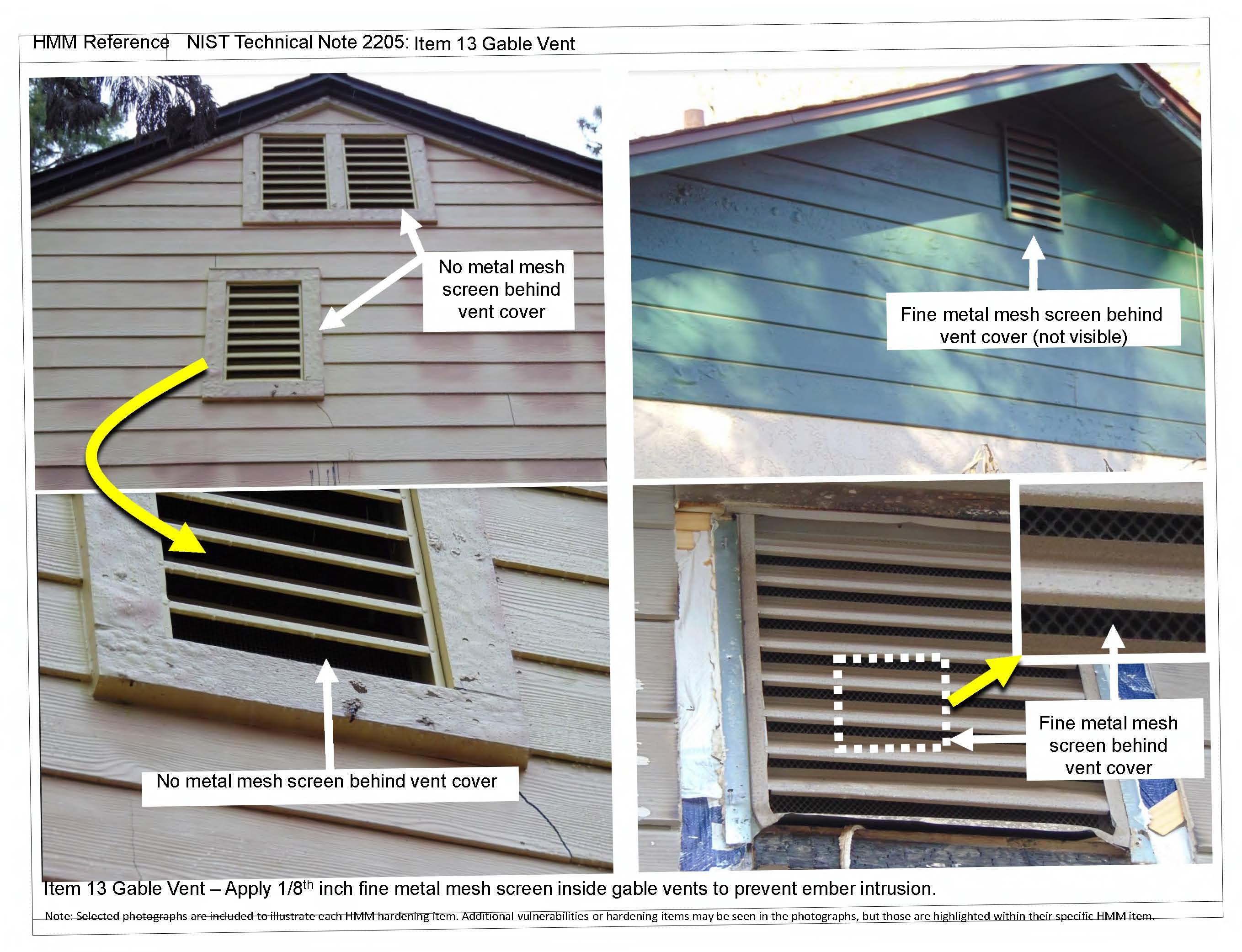
Unscreened vent
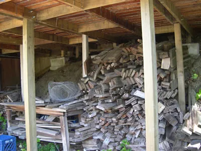
Open deck skirting
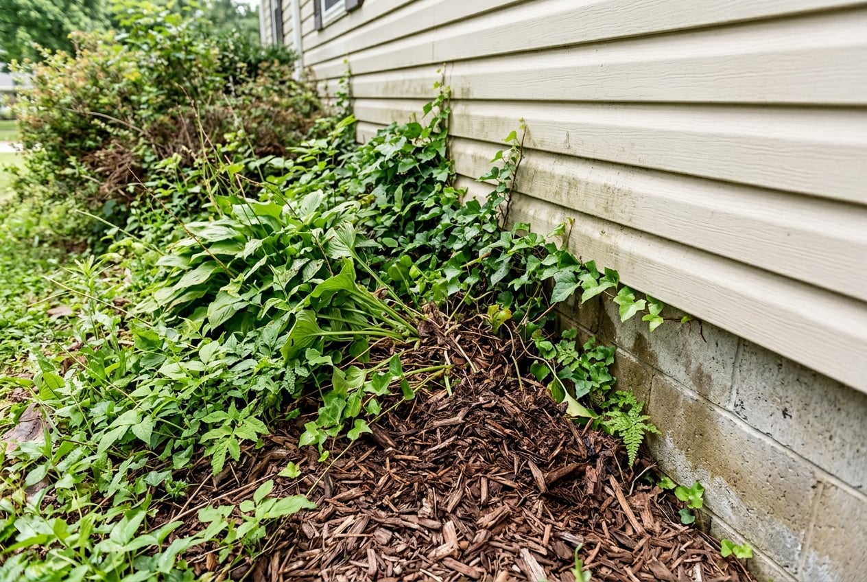
Zone 0 violation
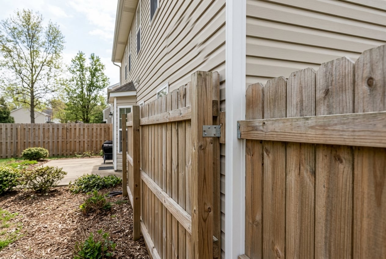
Fence flame path
$149 Assessment Report
California Wildfire Assessment Report
Find out what wildfire risk models and California building codes flag on your property. No site visit. Results same day.
30-minute phone session
We guide you through photos of vents, eaves, decks, fencing, roof, and vegetation. No site visit.
Photo-by-photo analysis
Each finding includes what we see, why it matters, and the specific code section it relates to.
Prioritized action plan
30-day, 90-day, and 12-month timelines. Every item cites CBC Chapter 7A, PRC 4291, or AB 38.
Defensible space scored
Zone 0, Zone 1, and Zone 2 rated for your specific property with clear action items.
Insurance documentation
Mapped to Regulation 2644.9 categories. Hand it to your broker for FAIR Plan or discount qualification.
Contractor-ready fix list
Specific materials, code references, and priority rankings. Any licensed contractor can use it.
Built by a California wildfire defense company from real-world Bay Area experience.
Free Wildfire Map
Not ready for a full assessment? Enter any California address to see fire hazard severity zones, vegetation density, and nearby fire history.
Open Free Wildfire MapDefensible Space & Home Hardening
California law requires property owners in fire hazard zones to maintain defensible space and harden their homes.
Ember-Resistant Zone
0-5 ft
Remove all combustible material within five feet. No mulch, no plants, no firewood. Hardscape only.
Lean, Clean, and Green
5-30 ft
Well-spaced, low plants. Trim branches 6 ft from ground. 10 ft between canopies. Grass to 4 inches.
Fuel Reduction Zone
30-100 ft
Remove ladder fuels. Space shrub groups. Create vertical gaps between ground cover and canopies.
Priority Order
Screen all vents with 1/8-inch metal mesh
Clear Zone 0 (first 5 feet)
Clean gutters and roof of debris
Replace or disconnect wood fence at house
Enclose open eaves and soffits
Enclose or screen deck skirting
Exterior Sprinkler Systems
FireRoofs installs automated exterior sprinkler systems in our Bay Area service area (48 communities, 6 counties). They saturate the property before fire arrives, buying critical time.Mill Valley is not in our installation area, but the assessment report identifies which hardening measures will have the greatest impact on your property.
Common Questions
Is Mill Valley in a high fire hazard zone?
Yes. CAL FIRE designates Mill Valley as a Very High Fire Hazard Severity Zone (VHFHSZ). In 2025, CAL FIRE released updated maps that expanded the VHFHSZ boundaries even further into Mill Valley. Approximately 99% of properties in Mill Valley have some level of wildfire risk according to First Street Foundation. The designation is based on the city's steep topography, dense vegetation, and documented fire history.
What was the last major wildfire near Mill Valley?
The most destructive fire in Mill Valley's history was the 1929 Mill Valley Fire, which destroyed 117 homes over three days after starting near railroad tracks and being driven by 30 mph winds. The 1945 Carson Canyon Fire burned 18,000 acres on Mount Tamalpais. While no large fire has burned directly through Mill Valley in recent decades, fire officials emphasize that the conditions that produced those historic fires still exist and have worsened with climate change and increased development.
Will wildfire risk affect my insurance in Mill Valley?
It already has for many homeowners. Multiple insurers have non-renewed policies across Marin County, and FAIR Plan enrollment has increased significantly. FAIR Plan policies provide basic fire coverage but are limited in scope and often require a supplemental Difference in Conditions (DIC) policy. California's Safer from Wildfires regulation (Regulation 2644.9) now requires admitted insurers to factor documented home hardening and defensible space improvements into their risk assessments. Documenting your property's mitigation measures is the strongest step you can take.
What is the cheapest way to protect my Mill Valley home from wildfire?
Start with Zone 0 (the first five feet around your home). Remove all combustible material, mulch, and vegetation within five feet of your foundation, decks, and attachments. Clean gutters and roof of debris. Screen attic and crawlspace vents with 1/8-inch metal mesh. Remove any wood fence that connects directly to your house. These steps cost little to nothing and address the ignition pathways that embers exploit. The Marin Wildfire Prevention Authority offers free defensible space assessments for Mill Valley residents.
How does a photo-based wildfire assessment work?
A photo-based wildfire assessment is a 30-minute guided phone session where you walk around your property and photograph specific elements: vents, eaves, decks, fencing, roof, vegetation clearance, and attachments. A wildfire defense specialist analyzes each photo against California Building Code Chapter 7A, PRC 4291, and AB 38 requirements. You receive a written report with photo-by-photo findings, code citations, a prioritized action plan, defensible space zone ratings, and insurance documentation you can hand to your broker or any local contractor.
Not in our service area
Your property, your report.
FireRoofs installs sprinkler systems in our Bay Area service area. The California Wildfire Assessment Report is available for any property in the state.
This page is not an emergency resource. If you see fire or smoke, call 911. For evacuation alerts in Marin County, register for AlertMarin.