Ladera Wildfire Defense
Ladera is a quiet, 800-home community tucked between Portola Valley and the I-280 corridor in unincorporated San Mateo County. It does not make wildfire headlines, and that is part of the problem. Residents often underestimate their exposure because the community feels suburban, not rural. But Ladera's western boundary abuts open space that connects to the same Windy Hill and Coal Creek preserves that surround Portola Valley. During offshore wind events, fire from those preserves would run east downslope directly into Ladera. The community has no dedicated fire station and relies on the Menlo Park Fire Protection District for mutual aid.
$149 Wildfire Report for Ladera Homeowners
See what California wildfire codes require for your Ladera property. Covers roof, vents, defensible space, and insurance paperwork. Get your report in minutes.
of Ladera is an unincorporated WUI community
San Mateo County
Ladera borders the same open space preserves as Portola Valley, with fire-prone grassland and oak woodland on its western boundary.
FireRoofs Premier Home Hardening & Active Defense
FireRoofs provides premier wildfire defense and home hardening for Ladera properties. We combine automated exterior sprinkler systems with structural hardening that addresses every ember entry point on the home.
Automated Exterior Sprinklers
Dual-detection roof and perimeter sprinklers with satellite monitoring
Ember-Resistant Vents
Retrofit vents that seal the attic from ember intrusion
Noncombustible Fencing
Eliminate the fence-to-structure flame path
Zone Zero Hardening
Clear combustible material within 5 feet of the structure
Vegetation Fire Retardant
Applied to surrounding landscape for ember resistance
Insurance Evidence Packet
Mapped to California Regulation 2644.9 for carrier submission
Ladera is a small unincorporated community in San Mateo County bordered by open space and grassland on multiple sides. Despite its proximity to Stanford and suburban Menlo Park, Ladera properties face wildfire exposure from surrounding hillsides and dry-season grass fires. The community's established landscaping and architectural style create hardening needs that FireRoofs addresses with minimal visual impact.
Ember-Resistant Vent Retrofit for Ladera Homes
Ladera homes built in the mid-20th century often retain original vent configurations with mesh openings too large to block modern ember threats. Grassland fires on adjacent hillsides can launch embers that travel directly into residential areas. Vulcan Vents with ASTM E2886 certification replace outdated mesh with dual-layer ember protection and intumescent sealing technology, meeting current Chapter 7A WUI standards.
Vulcan Vents - California Code ComplianceStainless Steel Gutter Guard Installation for Ladera
Ladera homes surrounded by live oak and eucalyptus trees collect leaf litter and bark debris in gutters that become a readily ignitable fuel source during fire season. Our micro mesh gutter guards fabricated from noncombustible stainless steel keep gutters clear of fuel while requiring minimal maintenance. This is one of the most cost-effective home hardening upgrades available for Ladera homeowners.
Fire Safe San Mateo - Home HardeningOpen Eave Enclosure for Ladera Residences
Ladera's ranch-style and mid-century homes commonly have open eave construction with exposed rafter tails and blocking. This architecture creates vulnerable entry points where embers can lodge and ignite attic materials. Our enclosure retrofit uses noncombustible soffit material matched to existing trim colors, with integrated WUI-compliant vents that maintain proper attic airflow per California ventilation requirements.
CALBO - Chapter 7A UpdatesDeck-to-Structure Ember Break for Ladera Homes
Where Ladera decks and patios attach to the house, embers accumulate in the joint between decking and siding. This narrow gap acts as a fire starter, igniting both surfaces and penetrating the wall. Our ember break installs a noncombustible flashing and hardscape strip at every deck-to-wall connection, creating a fireproof separation that the Safer from Wildfires framework recognizes as a key structural mitigation measure.
CA Dept of Insurance - Safer from WildfiresNon Combustible Fencing for Ladera Properties
Wood fencing along Ladera property lines can carry fire from grassland hillsides directly to the home, bypassing all defensible space clearance. California Zone 0 regulations under AB 3074 mandate noncombustible fencing within 5 feet of any structure. Our installation replaces vulnerable wood sections with aluminum or steel fence panels that match existing fence heights and styles while eliminating the combustible pathway.
Ready for Wildfire - Defensible SpaceWhy Home Hardening Matters in Ladera
Limited road access makes Ladera one of the communities where automated defense matters most. If you cannot count on being able to evacuate safely or on fire crews arriving quickly, your property needs to defend itself
FireRoofs builds systems for exactly that scenario: fully automated sprinkler activation, combined with physical hardening that removes every ember entry point. The evidence packet documents it all for insurance.

CAL FIRE Very High Fire Hazard Severity Zones (VHFHSZ) shown in red/orange
Source: CAL FIRE Fire Hazard Severity Zone data via Bay Area News Group
CAL FIRE High Fire Hazard Severity Zone
Ladera falls within a Fire Hazard Severity Zone designated by CAL FIRE. Properties on the western edge closest to open space face the highest risk levels.
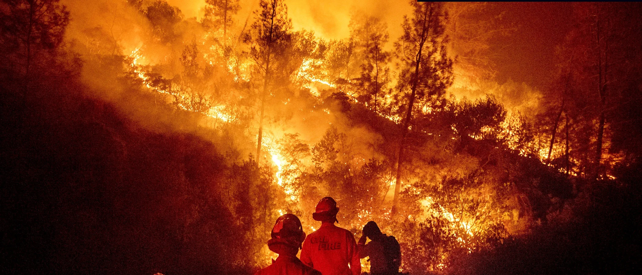
Ladera's Wildfire Record
Understanding past fires helps predict future risk. Here are the most significant fire events near Ladera.
Burned 86,509 acres in the Santa Cruz Mountains. While Ladera was not directly impacted, nearby communities were evacuated.
Burned over 700 acres in the nearby Kings Mountain area, illustrating fire risk to western San Mateo County communities.
Local Risk Factors
Wildland Proximity
Ladera borders Windy Hill Open Space Preserve and other wildland areas to the west, creating a direct fire pathway into the community.
Mature Tree Canopy
Dense oak and eucalyptus canopy throughout the neighborhood creates continuous fuel connections between properties.
Offshore Wind Exposure
During Diablo wind events, hot dry winds funnel over the ridge and accelerate through the I-280 corridor.
Single Access Points
Several Ladera neighborhoods have limited ingress/egress, complicating evacuation during fire events.
Book a free on-site evaluation. We will design and install the right sprinkler and hardening system for your home.
Book Free EvaluationGet the $149 assessment report. Find out what wildfire risk models flag on your property. Results in minutes.
Get $149 ReportLadera Fire Environment
Vegetation Types
Wind Patterns
Offshore winds (NE/E) in fall; marine layer and fog in summer
Topography
Elevation approximately 300-600 ft. Moderate slopes on the western edge with flatter terrain toward I-280.
Fire District
Woodside Fire Protection District
Insurance Impact
Ladera properties near open space have experienced non-renewals from several insurers. Proximity to wildland and WUI designation affects insurance availability.
Protecting Your Ladera Home & Family
Living in a fire-prone area means being proactive. Here are the steps every Ladera homeowner should take to protect their property and prepare for wildfire season.
Evacuation Planning
Register for SMC Alert emergency notifications. Know routes to Alpine Road and I-280 from your property. During fire events, leave early and do not wait for mandatory evacuation orders.
Defensible Space
Maintain 100 feet of defensible space. Focus on removing dead vegetation, thinning tree canopy to prevent crown fire transmission, and replacing flammable landscaping materials adjacent to structures.


Your Local Fire Safe Council
FIRE SAFE San Mateo County
The FIRE SAFE San Mateo County offers free resources, community chipping programs, home assessments, and education to help Ladera residents reduce wildfire risk and prepare for fire season.
Visit FIRE SAFE San Mateo CountyLadera Wildfire Preparedness Resources
FIRE SAFE San Mateo County
Free chipper program, home hardening guides, fire-safe landscaping information.
Fire Safe San MateoSan Mateo County Fire Hazard Zones
Official San Mateo County fire hazard maps and building code requirements.
San Mateo CountyCAL FIRE Defensible Space Guide
Official California guide to creating defensible space zones around your property.
CAL FIREProtect Your Ladera Home with FireRoofs
Defensible space and evacuation planning are essential, but they have limits. When embers are raining down and flames are approaching, your home needs both an automated active defense system and structural hardening that eliminates every ember entry point.
FireRoofs combines automated exterior sprinkler systems with structural home hardening for Ladera properties. Our Detect → Alert → Defend system uses intelligent wildfire detection cameras, satellite monitoring, and high-pressure water to saturate your property. Our hardening scope seals every vulnerability embers exploit.
- Automated exterior sprinklers: roof and perimeter coverage with dual detection
- Ember-resistant vent retrofits to seal the attic from intrusion
- Noncombustible fencing to eliminate the fence-to-structure flame path
- Zone Zero landscape hardening within 5 feet of the structure
- Vegetation fire retardant application for surrounding landscape
- Class A firefighting foam add-on: 100% biodegradable, non-toxic, rinses off through sprinklers
- Insurance evidence packet documenting all upgrades, mapped to California Regulation 2644.9


Local Wildfire Resources for Ladera Homeowners
Rules and requirements can change. Verify current requirements with your city or fire district before taking action.

Tree Removal and Defensible Space Rules
County of San Mateo permits for native trees over 10 inches diameter. Exemptions for defensible space within 30 feet. WFPD Ordinance 24-01 applies.
Fire Hazard Severity Zone: Very High. Local Responsibility Area.

Free Programs for Ladera Homeowners
- WFPD chipper program

Statewide Zone 0 Compliance Timeline
Board of Forestry rulemaking targeted for completion by December 31, 2025. New construction: compliance begins once rules are adopted (projected 2026). Existing structures: 3-year phase-in (compliance expected by approximately 2028-2029).
State Defensible Space (PRC 4291)
Zone 0: 0-5 feet, ember-resistant/noncombustible. Zone 1: 5-30 feet, lean, clean, and green. Zone 2: 30-100 feet, reduced fuel loading. Annual compliance inspections by local fire districts during fire season.
California Building Code
Effective 2026, California Wildland-Urban Interface Code (CWUIC) Part 7 replaces CBC Chapter 7A. Applies to new construction in designated fire hazard zones.
How FireRoofs Fits In
Understanding your local requirements is the first step. A FireRoofs automated defense system works alongside your defensible space, home hardening, and community efforts to give your home the strongest possible protection. During your free property evaluation, our team reviews your property in the context of Ladera's specific requirements and helps you understand how active defense fits into your overall wildfire strategy.
Nearby Communities We Serve
FireRoofs also installs wildfire defense systems in neighboring communities with similar WUI risk profiles.
2026 Insurance Alert for Ladera Homeowners
Homeowners in Ladera are facing surging FAIR Plan rates and non-renewals from private carriers. California's Safer from Wildfires framework now requires participating insurers to offer discounts for documented mitigation systems. FireRoofs provides the engineering documentation and evidence packet designed to help you qualify for the voluntary market.
California's SB 429 (effective January 1, 2026) establishes the nation's first public wildfire catastrophe model, giving homeowners new tools to understand insurance risk scores. Ask HydroIQ what this means for Ladera homeowners.
Request a Free Property EvaluationAsk HydroIQ About Ladera - Free AI Wildfire Assistant
Get instant answers about Ladera's wildfire risk level, defensible space requirements, fire history, FAIR Plan insurance options, and how exterior sprinkler systems can protect your home. HydroIQ covers communities across all nine Bay Area counties.
Protect Your Ladera Property Today
Every Ladera property is different. Get a free evaluation of your home's wildfire exposure and a custom defense plan.
Common Questions
What wildfire risk does Ladera face?
Ladera is designated a High fire risk zone by CAL FIRE. San Mateo County fire maps confirm elevated exposure driven by coast live oak woodland and eucalyptus fuel loads and seasonal offshore winds. Ladera borders Windy Hill Open Space Preserve and other wildland areas to the west, creating a direct fire pathway into the community.
How does FireRoofs protect Ladera homes from wildfire?
FireRoofs provides both active defense and passive home hardening for Ladera properties. Active defense includes automated exterior sprinkler systems with dual detection, satellite monitoring, and intelligent fire detection cameras. Passive hardening covers ember-resistant vent retrofits, noncombustible fencing, Zone Zero landscape hardening, exterior cladding upgrades, and vegetation fire retardant. Every upgrade is documented in one evidence packet mapped to California Regulation 2644.9 for insurance recognition.
What does home hardening include for a Ladera property?
Home hardening for Ladera properties addresses every ember entry point on the structure. FireRoofs performs ember-resistant vent installation, noncombustible fencing replacement, eave and soffit sealing, Zone Zero landscape clearance within 5 feet of the structure, vegetation fire retardant application, and exterior cladding upgrades where needed. Scope is determined during a free property evaluation and accounts for local terrain and elevation changes. All work is documented for insurance submission.
Where can I get instant answers about Ladera's wildfire risk?
HydroIQ is FireRoofs' free wildfire assistant that provides instant, city-specific answers about Ladera's fire hazard zone classification, defensible space requirements, local fire history, FAIR Plan insurance options, and wildfire defense systems. No sign-up required. Visit fireroofs.com/hydroiq to learn more or ask a question directly.
What is California home hardening?
California home hardening is the process of retrofitting a structure to resist wildfire ember intrusion and radiant heat exposure. It includes replacing combustible building materials, sealing openings such as attic vents and eaves, installing noncombustible fencing, clearing the Zone Zero perimeter within 5 feet of the structure, and applying fire-resistant treatments. Home hardening is one of the 12 mitigation categories under California Regulation 2644.9 (Safer from Wildfires) that participating insurers must recognize when setting premiums.
How do I get off the California FAIR Plan?
To transition from the California FAIR Plan back to the voluntary insurance market, homeowners need to demonstrate documented wildfire risk reduction. This includes property-level mitigation such as home hardening, automated exterior sprinkler systems, and defensible space maintenance. Under California Regulation 2644.9, admitted insurers are required to offer premium discounts for documented mitigation across 12 categories. FireRoofs provides the upgrades and the evidence packet that documents each improvement for your insurer or broker.
What are the 12 Safer from Wildfires mitigation categories?
California Regulation 2644.9 defines 12 mitigation categories that insurers must recognize: (1) Class A fire-rated roof, (2) Enclosed eaves, (3) Ember-resistant vents, (4) Exterior wall cladding, (5) Dual-pane or tempered windows, (6) Noncombustible fencing within 5 feet, (7) Defensible space Zone 0-2 maintained, (8) Community-level mitigation (Fire Risk Reduction Community), (9) Active fire defense system such as exterior sprinklers, (10) Fire-resistant landscaping, (11) Access and water supply, (12) Structure-specific risk reduction. FireRoofs addresses categories 1 through 10 directly.
Do exterior roof sprinklers qualify for insurance discounts in California?
Yes. Automated exterior sprinkler systems are recognized under Category 9 (Active Fire Defense System) of California Regulation 2644.9. When documented in an evidence packet and submitted to your insurer, they count toward the mitigation credits that admitted carriers are required to apply. FireRoofs installs dual-detection exterior sprinkler systems and provides the documentation package for insurance recognition. SB 429 (effective January 1, 2026) further supports this by establishing a public wildfire catastrophe model that factors documented improvements into risk scoring.
What defensible space rules apply in Ladera?
Ladera is covered by WFPD Ordinance 24-01, which mandates fuel mitigation with annual inspections. San Mateo County requires permits for native trees over 10 inches diameter, with exemptions for defensible space within 30 feet of structures.